
FEATURED
The best of SatNews—essential reads, standout reporting, and hand-picked stories worth your time.

Project Kuiper is now known as Amazon LEO
Amazon LEO is a simple nod to the Low Earth Orbit (LEO) satellite constellation that powers the network. Seven years ago, Amazon set out to design the most advanced satellite communications network ever built. The company’s vision was simple: There ...
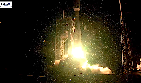
UPDATE: ULA’s Atlas V rocket launches ViaSat-3 Flight 2 mission doubling the bandwidth of Viasat’s entire fleet + creating multi-orbit network
A United Launch Alliance (ULA) Atlas V rocket carrying the ViaSat-3 Flight 2 (F2) mission for Viasat, Inc., a global leader in satellite communications, lifted off on Nov. 13 at 10:04 p.m. EST from Space Launch Complex-41 at Cape Canaveral ...
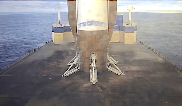
Multiple successes as Blue Origin launches New Glenn’s orbital launch vehicle with NASA’s EscaPADE to Mars + and landed the reusable large booster
The New Glenn orbital launch vehicle successfully completed its second mission, deploying NASA’s Escape and Plasma Acceleration and Dynamics Explorers (ESCAPADE) twin-spacecraft into the designated loiter orbit, and landing the fully reusable first stage on Jacklyn in the Atlantic Ocean. Photos ...

Star Catcher + Intuitive Machines demo power beaming for extended Lunar surface operations
Power beaming demo at Kennedy Space Center The lunar South Pole has drawn sustained attention from scientists, space agencies, and commercial innovators due to its potential reserves of water ice and its strategic value for long-term exploration. Deep craters remain ...

NASA ready with dual mission from Andøya Space
Two sub-orbital rockets from NASA Wallops have been installed on the pads at Andøya Space, ready for their launch campaign. Suborbital rockets on pads Kolbjørn Blix, VP Sub-Orbital at Andøya Space, said, “I must admit that I am especially proud ...
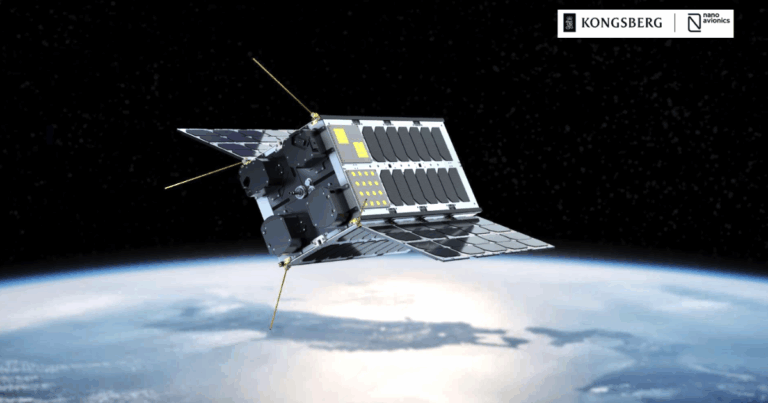
ESA selects Kongsberg NanoAvionics to build spacecraft for the ESA-EC “IOD/IOV” program
ESA, through its European Space Research and Technology Centre (ESTEC), has selected Kongsberg NanoAvionics (NanoAvionics) to build a large CubeSat platform for its in-orbit demonstration/in-orbit validation (IOD/IOV) program. Under the project name IHE1-5 CubeSat, NanoAvionics will build a 12 to ...

INNOSPACE to launch HANBIT-Nano SPACEWARD mission on November 22 including 5 smallsats
INNOSPACE (KS:462350), a South Korean satellite launch service company targets 3:00 p.m. on November 22 (Brazil time) for the launch of its first commercial launch vehicle ‘HANBIT-Nano’ as part of the SPACEWARD mission. The target launch date was determined following an ...

Rocket Lab launches “The Nation God Navigates” to join SAR constellation for Japan
Photo by Satnews. "The Nation God Navigates” launched from Rocket Lab Launch Complex 1 in New Zealand at 19:51 UTC on November 5, 2025, deploying QPS-SAR-14, nicknamed YACHIHOKO-I for the Japanese god of nation-building, to a 575km circular Earth orbit ...

Three Chinese astronauts stranded at the Chinese space station as the return capsule hit by debris
Double the taikonauts makes a full house. Three Chinese astronaurs, or taikonauts, will be delayed unexpectedly on China's Tiangong space station after their return capsule was struck by a presumed piece of orbital debris on Wednesday. There return date was ...
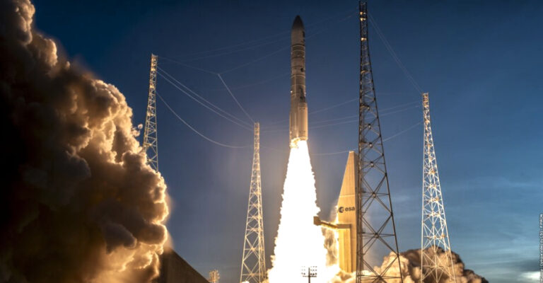
Sentinel-1D climbs to orbit via an Ariane 6
Ariane 6 launch with the Sentinel-1D satellite aboard from Europe's Spaceport The Sentinel-1 mission, which provides radar vision for the Copernicus Earth observation program, has added the on-orbit arrival in SSO of the final first generation series of satellites, the ...
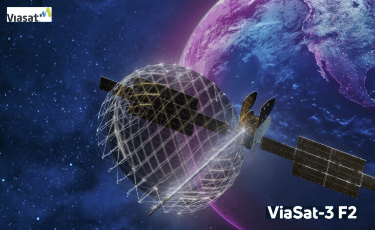
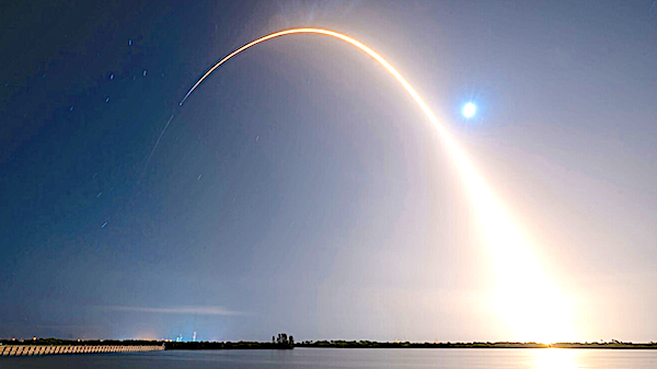
ViaSat-3 F2 satellite confirmed for launch on November 5th, 2025
Expected to more than double Viasat’s current network capacity, ViaSat-3 Flight-2 is designed to fuel customer growth, supporting next-generation connectivity platforms such as Viasat Amara, NexusWave, and Government Hybrid SATCOM architecture Viasat, Inc. (NASDAQ: VSAT) has confirmed the scheduled launch ...
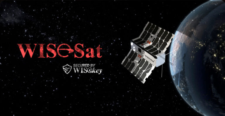
WISeKey affiliate WISeSat.Space teams with INNOSPACE for post-quantum satellite launches
WISeKey International Holding’s subsidiaries WISeSat.Space and SEALSQ Corp. have signed a Memorandum of Understanding (MoU) to establish a strategic partnership with INNOSPACE Co., Ltd., a South Korean satellite launch service company. This collaboration marks a significant milestone in advancing secure ...

Lynk + Omnispace reveal plans to merge to deliver global D2D connectivity with partner SES
Lynk Global and Omnispace plans to merge to deliver a comprehensive, Direct-to-Device (D2D), connectivity solution, bridging the gap between today’s satellite and terrestrial networks. Following the merger, SES will become a major strategic shareholder, facilitating a robust deployment of D2D ...

Rocket Lab’s next Electron Launch will be the 6th mission for iQPS
Rocket Lab Corporation (Nasdaq: RKLB) has announced the launch window for its next mission for multi-launch customer, Institute for Q-shu Pioneers of Space, Inc. (iQPS), a Japan-based Earth imaging company—this mission will be Electron’s 74th launch to date and 16th ...
INNOSPACE obtains launch authorization for 1st commercial launch mission ‘SPACEWARD’
INNOSPACE (KS:462350), a South Korean satellite launch service company, announced that it has become the first private company to obtain a commercial launch authorization from the Korea AeroSpace Administration (KASA)—with this authorization, INNOSPACE has completed all approval procedures for the maiden ...
Rocket Lab launches Synspective’s “Owl New World” mission with improved SAR capabilities
Rocket Lab Corporation (Nasdaq: RKLB), a global leader in launch services and space systems, today successfully launched its 15th mission of the year and the first of 21 new launches for Synspective and 73rd launch overall. Photos captured by Satnews ...
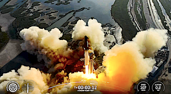
“Every major objective of the flight test was achieved” as Starship aces its 11th test for SpaceX
On Monday, October 13, 2025, at 6:23 p.m. CT, Starship lifted off from Starbase, Texas on its eleventh flight test. This was the final flight of the second-generation Starship and first generation Super Heavy booster, as well as the final ...
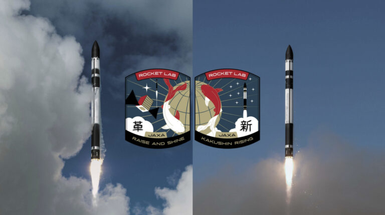
Rocket Lab secures multiple launches with JAXA
Rocket Lab Corporation (Nasdaq: RKLB) has signed a direct contract for two dedicated Electron launches with the Japan Aerospace Exploration Agency (JAXA) – signifying the criticality of Electron to international space agencies requiring responsive launch and dedicated access to space ...
Amazon’s KF-03 mission possible delay with prohibitive weather conditions on Thursday for SpaceX’s Falcon 9 launch
Project Kuiper deployed 24 satellites aboard its KF-01 mission on a Falcon 9 rocket from SpaceX Photo by Image: SpaceX SpaceX is targeting Thursday, October 9 for a Falcon 9 launch of the KF-03 mission to orbit from Space Launch ...

Blue Origin’s successful launch of New Shepard-36 and the crew of six
Blue Origin's New Shepard vehicle lifted off from their West Texas launch site today at 9:40 a.m. EDT (1340 GMT; 8:40 a.m. local Texas time), launching this suborbital flight known as NS-36. Photos captured by Satnews. New Shepard's first stage ...