

The MWIs will provide cloud and precipitation products and all-weather surface imagery to support numerical weather predictions at regional and global scales. Omnisys, AAC Clyde Space’s new subsidiary, secured an […]
Satellite Data
Near Real-Time Imagery For The TAK Mobile Platform Is Resultant Of The PAR Government + BlackSky Team Up — Demos @ GEOINT 2022
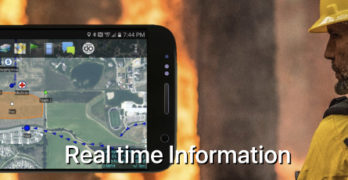
PAR Technology Corporation (NYSE: PAR) has noted that their wholly-owned subsidiary, PAR Government Systems Corporation (PGSC), has incorporated BlackSky’s (NYSE: BKSY) commercial satellite data into the Sit(x)™ cloud-native situational awareness […]
ASTERRA Will Engage Attendees @ GEOINT With Satellite Data Infrastructure Monitoring Apps

ASTERRA (formerly Utilis) will be participating at the United States Geospatial Intelligence Foundation Symposium later this month, including the attendance of their CEO and CTO, as they share the full […]