

Orbital Insight has secured new, global customer agreements — including new customer wins and expansions — that leverage the company’s recently released, geospatial analytics platform, TerraScope, a self-serve, multi-sensor analytics […]
Geospatical Intelligence
UPDATE: Rocket Lab’s 1st Launch from Wallops is a success as the Electron launch vehicle pushes three HawkEye 360 smallsats to orbit

Rocket Lab USA, Inc. (Nasdaq: RKLB) has successfully launched the company’s 33rd Electron rocket and first mission from Virginia after an earlier halt in the proceedings due to adverse weather […]
A controlling interest in Descartes Labs is acquired by Antarctica Capital

Affiliates of Antarctica Capital (“Antarctica”) has acquired a controlling interest in Descartes Labs, a solutions provider of geospatial intelligence to commercial and government clients — this acquisition complements Antarctica’s existing […]
Now serving… SAR imagery from Capella Space added to Orbit Logic’s SpyMeSat app

Orbit Logic has added access to synthetic aperture radar (SAR) imagery from Capella Space in a new version of their SpyMeSat mobile app and enhanced SpyMeSat web application. With the […]
A new manufacturing facility is opened by Hawkeye 360

HawkEye 360 Inc. has held their grand opening of the company’s Advanced Technology and Development Center in Herndon, Virginia. This 19,000 square-foot data processing, software development and satellite manufacturing facility […]
Collaboration between Satellite Vu + Landmark will provide climate change data to the UK land + property market sectors

Satellite Vu has partnered with Landmark Information Group to provide vital climate data to the real estate market. Satellite Vu will provide data from their thermal, infrared satellites to Landmark, […]
Panaxx and DSG Global Consultants now stratigic business partners

“DSG Global is excited to be working with Panaxx as we assist our collective clients in fielding their state-of-the-art defense, geo-intelligence and secure communication capabilities to our allies…” Panaxx Corporation […]
Continuing Their Support For USAF Geospatial Intelligence Is Raytheon Intelligence & Space

Raytheon Intelligence & Space, a Raytheon Technologies business, has been awarded a five-year indefinite delivery, indefinite quantity (IDIQ) contract to continue Geospatial Intelligence system mission support and training for the […]
Near Real-Time Imagery For The TAK Mobile Platform Is Resultant Of The PAR Government + BlackSky Team Up — Demos @ GEOINT 2022

PAR Technology Corporation (NYSE: PAR) has noted that their wholly-owned subsidiary, PAR Government Systems Corporation (PGSC), has incorporated BlackSky’s (NYSE: BKSY) commercial satellite data into the Sit(x)™ cloud-native situational awareness […]
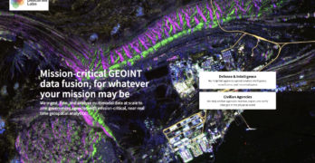
Descartes Labs Government Will Showcase ALL-INT Data Fusion For Autonomous Target Tracking At Planetary Scale At GEOINT
Descartes Labs Government, a solutions provider of geospatial intelligence originating out of Los Alamos National Laboratory, will showcase ALL-INT data fusion for autonomous detection and tracking of targets across the […]