

According to a new research report from specialist IoT analyst firm Berg Insight, the global satellite IoT communications market is growing at a strong steady pace. Despite the impact of […]
Remote Sensing
ST Engineering iDirect and Türksat’s contract furthers their provision of ground systems for Türksat 5B

ST Engineering iDirect, provider of satellite communications, signed a multi-million dollar contract with leading regional satellite operator, Türksat. for the ground systems required to run a variety of services over […]
Teaming of Orbital Insight + ASTERRA to implement infrastructure monitoring

Earth observation company, ASTERRA, has executed a teaming agreement with Orbital Insight to jointly provide remote sensing analytics to water utilities, infrastructure organizations as well as numerous other industries. ASTERRA […]
NanoAvionics’ two new satellites bus range enables advanced space missions

NanoAvionics, described as global mission integrator, has added two microsatellite buses, the MP42H and the MP42D, to its product line based on its flagship MP42 bus. These buses are able […]
China’s Long March rocket launches 16 satellites
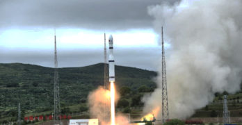
According to the Chinese news agency, Xinhua, 16 new satellites were delivered into space from the Taiyuan Satellite Launch Center in the northern province of Shanxi. The satellites, including a […]
A controlling interest in Descartes Labs is acquired by Antarctica Capital

Affiliates of Antarctica Capital (“Antarctica”) has acquired a controlling interest in Descartes Labs, a solutions provider of geospatial intelligence to commercial and government clients — this acquisition complements Antarctica’s existing […]
Planet signs a new contract with the German BKG for daily hi-res satellite data

Planet Labs PBC has announced that their wholly owned subsidiary, Planet Labs Germany GmbH, has signed a new contract with the German Federal Agency for Cartography and Geodesy (BKG) to […]
ST Engineering iDirect’s installation process for Intelsat’s FlexEnterprise provides faster deployment of connectivity services

The Satmotion solution, developed by Integrasys, is now integrated into iDirect’s Velocity platform which underpins the global FlexEnterprise service fabric to enable even faster deployment of connectivity. ST Engineering iDirect, […]
UP42 And Airbus’ Copernicus Masters Challenge For Sustainable Urban Planning

This prestigious Earth Observation (EO) annual competition, Copernicus Masters, seeks to develop innovative applications of remotely sensed data that address Earth’s ongoing environmental, social, and business challenges. UP42, geospatial developer […]
Remote Sensing Satellite Imagery Assists Minderoo Foundation In ID’ing Thousands Of Waste Sites Across 25 Countries

A cutting-edge, new tool developed by Minderoo Foundation has identified thousands of waste sites across 25 countries for the first time using advanced satellite data technology and machine learning (ML) […]