

NV5 Global, Inc. (Nasdaq: NVEE) has closed their acquisition of L3Harris Technologies, Inc.’s Visual Information Solutions commercial geospatial technology and software business (“VIS”). First announced last December, the acquisition has […]
Geospatial
Orbital Insight expands global customer base with TerraScope platform rollout

Orbital Insight has secured new, global customer agreements — including new customer wins and expansions — that leverage the company’s recently released, geospatial analytics platform, TerraScope, a self-serve, multi-sensor analytics […]
Orbital Insight launched the TerraScope geospatial intelligence platform

Orbital Insight toward the close of last year announced the launch of TerraScope, a self-serve, analytics platform. Designed for automated analysis of phone, car, truck, ship location, and satellite imagery, […]
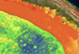
ACME Lithium locates samples with high lithium values using ASTERRA satellite technology

ASTERRA and ACME Lithium, Inc. (ACME) are collaborating together to take advantage of the former’s satellite-based technology that was used in the discovery of the highest values of lithium to […]
Maxar acquires Wovenware for Machine Learning and 3D data production expertise

Earlier this month, Maxar Technologies completed the acquisition of AI and software development company Wovenware — this acquisition significantly adds to Maxar’s software engineering and AI capabilities and talent. Founded […]
UPDATE 1: HawkEye 360 selected by NRO to develop expanded RF capabilities + the company adds new radar + comms signals to the firm’s mapping product

HawkEye 360 Inc. was awarded a contract from the NRO’s Commercial Systems Program Office (CSPO) — this contract will assess, mature, integrate, and operationalize commercial RF intelligence into the NRO’s […]
Spire’s contract extension with NASA for Earth Observation data

Spire Global, Inc. (NYSE: SPIR) (“Spire” or “the Company”), a global provider of space-based data, analytics and space services, announced today the continuation of its participation in NASA’s Commercial Smallsat Data […]
The team of UP42 + Trimble are going for faster info extraction from geospatial data
UP42 is collaborating with Trimble to offer automated Trimble® eCognition® software object-based image analysis and change detection solution. The unique, object-based, image analysis technology within Trimble eCognition dramatically enhances the […]
Teaming of Orbital Insight + ASTERRA to implement infrastructure monitoring

Earth observation company, ASTERRA, has executed a teaming agreement with Orbital Insight to jointly provide remote sensing analytics to water utilities, infrastructure organizations as well as numerous other industries. ASTERRA […]
A Canadian affiliate office for hydrospatial mapping services is opened by TCarta
TCarta Marine has formed TCarta Canada, based in Ottawa, Ontario. Offering the complete line of TCarta satellite-derived bathymetry (SDB) services and Trident SDB Toolbox software, the affiliate office is a […]