There will be a delay of NASA’s returning astronauts, Butch Wilmore and Suni Williams, due to numerous mechanical issues of the Boeing Starliner and, stressing the safety of the astronauts, […]
Data Analytics
Missile Defense Agency satellites track first hypersonic launch
The Defense Department’s advanced missile tracking satellites logged their first views of a hypersonic flight test this week, according to the Missile Defense Agency. MDA didn’t disclose the date of […]
Northrop Grumman to help digital transformation within defense intelligence community
Northrop Grumman Corporation (NYSE: NOC) was awarded a contract valued up to $700 million to provide the Defense Intelligence Agency (DIA) with an integrated cloud and sensor solution to provide […]
Maersk Supply Service selects Inmarsat’s Fleet Data IoT platform to enhance performance of battery optimized vessel
Maersk Supply Service has selected Fleet Data IoT platform from Inmarsat Maritime, a Viasat business, to help optimize the performance of its first vessel battery installation onboard Maersk Minder Offshore Supply Ship, in a solution […]
SatVu’s first First Light imagery from revolutionary thermal imaging satellite
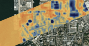
SatVu, the British climate tech company recently announced a significant achievement in space technology, releasing the First Light imagery from its revolutionary thermal imaging satellite, HOTSAT-1, at the same time […]
Accenture’s investment enables Open Cosmos to expand access to satellite data
Accenture (NYSE:ACN) announced an investment and collaboration with Open Cosmos at this year’s World Satellite Business Week in Paris. Open Cosmos is a space technology company that focuses on the […]
India signs Artemis Accords committing to transparent and sustainable space activity
In a ceremony recently held in Washington, D.C., the Republic of India became the 27th nation to sign the Artemis Accords demonstrating India’s commitment to sustainable and transparent space activity, […]
Cirium launches airline routes tool based on satellite flight tracking
Cirium has launched the aviation industry’s first Airline Routes tool to identify actual flights flown by aircraft type — the tool uses applied analytics to derive routes flown by airlines […]
Orbital Insight expands global customer base with TerraScope platform rollout
Orbital Insight has secured new, global customer agreements — including new customer wins and expansions — that leverage the company’s recently released, geospatial analytics platform, TerraScope, a self-serve, multi-sensor analytics […]
Orbital Insight launched the TerraScope geospatial intelligence platform
Orbital Insight toward the close of last year announced the launch of TerraScope, a self-serve, analytics platform. Designed for automated analysis of phone, car, truck, ship location, and satellite imagery, […]


