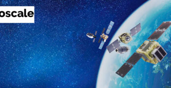
Recently, Astroscale UK, in partnership with Astroscale Japan, Orbit Fab and CGI, was awarded a Phase 1 UK Space Agency International Bilateral Fund grant — this grant aims to foster […]
Collaboration
Ovzon’s latest SSC order for enhanced SATCOM-as-a-Service communication
Ovzon has received a new order from SSC for Ovzon’s SATCOM-as-a-Service, which further strengthens the partnership between the two companies. The service is scheduled for delivery in the third quarter […]
Satellogic + Quant Data & Analytics secure a new agreement
Satellogic Inc. (NASDAQ: SATL) has signed an agreement with Quant Data & Analytics (“Quant”) — this strategic agreement leverages Satellogic’s high-resolution satellite imagery to serve and evolve the ever-expanding property […]
Swedish Space Corporation expands its Lunar Ground Network with VIRATEC partnership
SSC is expanding its global network of SSC CONNECT Lunar stations to meet the growing market demand. As part of this effort, SSC has added a new partner site in […]
OHB and Satellogic’s MoU to develop joint Earth observation applications
Satellogic Inc. (NASDAQ: SATL), provider of sub-meter resolution Earth Observation data (“EO”) collection, announced recently that it has signed a memorandum of understanding (“MoU”) with OHB SE, a German-based aerospace […]
Beyond Gravity wins contract for Ariane 6 to shape the next generation of European launch vehicles
Beyond Gravity announces they will help shape the next generation of European launch vehicles: For the new Ariane 6 rocket, this global supplier for the space industry will provide the […]
TTTech + STMicroelectronics providing high-performance networking solutions for deep space
TTTech and STMicroelectronics are celebrating seven years of collaboration in the space sector. TTTech’s advanced, safe, and reliable networking components and platform solutions, based on ST chips, are deployed in […]
The COSPAR satellite for advanced Earth science research enjoys collaboration from 5 countries
HEX20 is collaborating with Laboratory for Atmospheric and Space Physics (LASP – USA), National Central University Center for Astronautical Physics and Engineering (NCU CAPE – Taiwan), Laboratoire Atmosphères, Milieux, Observations […]
Astroscale + Momentus offer NASA a solution to reboost Hubble
Astroscale U.S. Inc. and Momentus Inc. (NASDAQ: MNTS) are collaborating to offer NASA a sustainable solution for the agency’s Hubble Reboost efforts. The two companies recently responded to NASA’s Hubble […]
Apogeo Space and INSIGHIO test satellite connection services in IoT
Apogeo Space announces a collaboration agreement with INSIGHIO P.C. (INSIGHIO), a company based in Athens, Greece, to test Apogeo Space’s satellite connection services on several INSIGHIO’s existing products and projects […]


