• Skip to primary navigation
  • Skip to main content
  • Skip to primary sidebar
  • Skip to secondary sidebar
  • NEWS:
  • SatNews
  • SatMagazine
  • MilSatMagazine
  • SmallSat News
  • |     EVENTS:
  • SmallSat Symposium
  • Satellite Innovation
  • MilSat Symposium

SatNews

  • HOME
  • Magazines
  • Events
  • SmallSat Symposium Updates
  • Industry Calendar
    • IN PERSON
    • VIRTUAL
  • Subscribe

RaCERS project to boost map-making and environmental monitoring

January 25, 2024

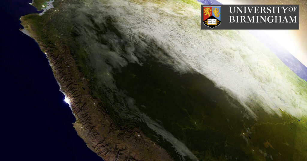
A University of Birmingham, UK, researcher is working on a space project that will bring map-making, environmental monitoring and natural hazard forecasting to a new level. The Radar Cluster for Earth Remote Sensing (RaCERS) project will deliver ‘swarms’ of cooperating microsatellites (smallsats) that fly in tight formation and provide a highly accurate profile of the Earth’s surface, and enhanced image resolution revealing, for instance, deforestation or forest thickening, the height of rivers or waterways, and areas of urban growth.

Professor Marco Martorella

Professor Marco Martorella from the Department of Electronic, Electrical and Systems Engineering is working with partners GeoOptics Switzerland, Tyvak International, National Interuniversity Center for Telecommunications, Pisa, and the Federal Institute of Technology, Zurich on the project.

Professor Martorella, who is Chair in Radio Frequency and Space Sensing at the University of Birmingham, is working on an academic consultant on the project, which will use his expertise in radar systems, sensing and signal processing to co-develop the advanced instrumentation needed for small satellites.

Flying in constellation will enable the RaCERS smallsats to simultaneously use altimetry, which measures height using the upward reflection of the radar beam, scatterometry, which passively senses the surface from many angles at once, providing more, and more precise, information and Synthetic Aperture Radar (SAR), which allows for active and high-resolution imaging of the earth surface.

Radar has strong benefits over visual light wavelengths for these types of measurements. It can sense during day or night and is not interrupted by cloud cover, which means it can deliver a continuous feed of highly accurate data about the surface of oceans, ice and land.

The feasibility study, which will involve developing bespoke equipment that pushes the boundaries of radar equipment and constellation flying, has now started. The second stage of the project would be funded by the European Space Agency. Delivery is expected by 2029.

Professor Martorella said, “Spaceborne radar is central to earth environmental monitoring and forecasting, and the constellations of RaCERS satellites, flying in a tightly orchestrated formation will deliver more accurate measurements than conventional, single satellites enabling more accurate determination of severe weather, soil moisture, surface winds, ocean circulation, and much more.”

Filed Under: Earth Remote Sensing, Forecasting, News, RaCERS Project, SAR, SAR, SAR Data, Satellites, Space Sensing Capabilities, University of Birmingham

Primary Sidebar

Most Read Stories

  • In Their Honor ... Lest We Forget
  • Russian satellite tumbling out of control
  • INNOSPACE signs strategic MoU with Saturn Satellite Networks to develop + launch smallsats
  • Rocket Lab partners with U.S.A.F. | AFRL for Neutron launch for rocket cargo missions
  • AST SpaceMobile to launch 243 satellites

About Satnews

  • Contacts
  • History

Archives

  • June 2025
  • May 2025
  • April 2025
  • March 2025
  • February 2025
  • January 2025
  • December 2024
  • November 2024
  • October 2024
  • September 2024
  • August 2024
  • July 2024
  • June 2024
  • May 2024
  • April 2024
  • March 2024
  • February 2024
  • January 2024
  • December 2023
  • November 2023
  • October 2023
  • September 2023
  • August 2023
  • July 2023
  • June 2023
  • May 2023
  • April 2023
  • March 2023
  • February 2023
  • January 2023
  • December 2022
  • November 2022
  • October 2022
  • September 2022
  • August 2022
  • July 2022
  • June 2022
  • May 2022
  • April 2022
  • March 2022
  • February 2022
  • January 2022
  • December 2021
  • November 2021
  • October 2021
  • September 2021
  • August 2021
  • July 2021
  • June 2021
  • May 2021
  • April 2021
  • March 2021
  • February 2021
  • January 2021
  • December 2020
  • November 2020
  • October 2020
  • September 2020
  • August 2020
  • July 2020
  • June 2020
  • May 2020
  • April 2020

Secondary Sidebar

We use cookies to ensure that we give you the best experience on our website. If you continue to use this site we will assume that you are happy with it.OkPrivacy policy
x
Sign up Now (For Free)
Access daily or weekly satellite news updates covering all aspects of the commercial and military satellite industry.
Invalid email address
Notify Me Regarding ( At least one ):
We value your privacy and will not sell or share your email or other information with any other company. You may also unsubscribe at anytime.

Click Here to see our full privacy policy.
Thanks for subscribing!