

On May 12th, Maxar collected new satellite imagery of several key locations in southern Ukraine that include Snake Island, Odesa and Mariupol.
Snake Island
This current imagery of the island (located in the Black Sea approximately 45 kilometers from the coast of Romania) and the surrounding area shows the aftermath of probable missile attacks on a Russian Serna-class landing craft near the island. Smoke contrails can be seen in the area, likely from missiles/munitions that had recently been fired toward the ship and the landing craft is seen making evasive maneuvers.
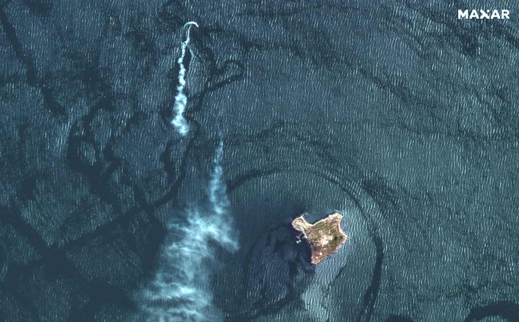

On the northern part of the island, a barge with a heavy-lift crane is positioned close to a sunken Serna-class landing craft that had recently been struck reportedly by Ukrainian drones. Nearby, an additional Serna-class landing craft is positioned at a landing ramp.

On the island itself, the imagery provides a closer view of the damaged buildings from recent attacks as well as several Russian air defense vehicles (Pantsir surface to air system) deployed nearby.


Odesa, Ukraine
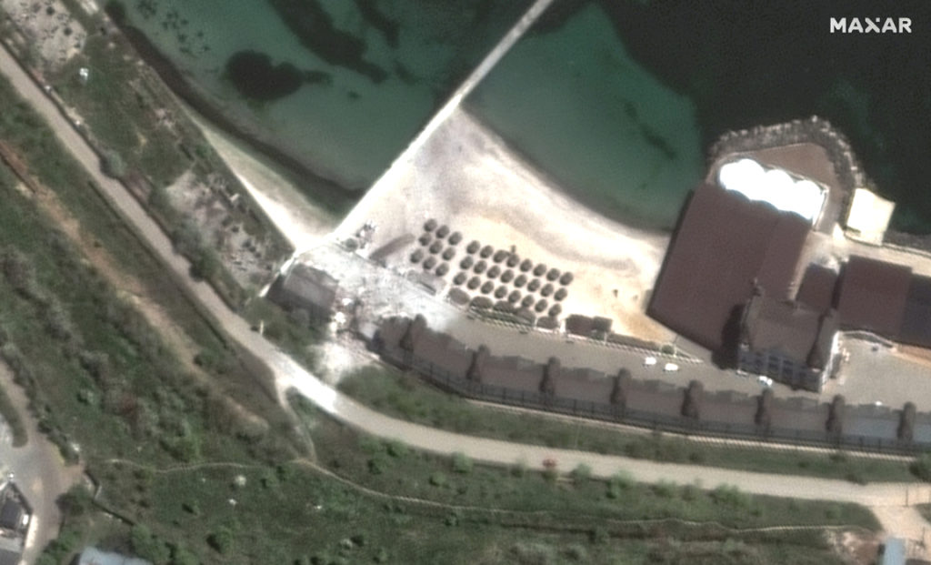
Maxar’s May 12th satellite imagery shows the aftermath of recent Russian attacks that damaged the Grande Pettine hotel, located on the beach by the Black Sea (location: 46.379, 30.749).

Additional damage is seen at several buildings at the Odesa airport (location: 46.417, 30.707) reportedly caused by Russian missile strikes.

Mariupol, Ukraine
These images focus on the Azovstal steel plant in eastern Mariupol and shows the aftermath of continued aerial and artillery attacks on the compound (location: 47.106, 37.607).

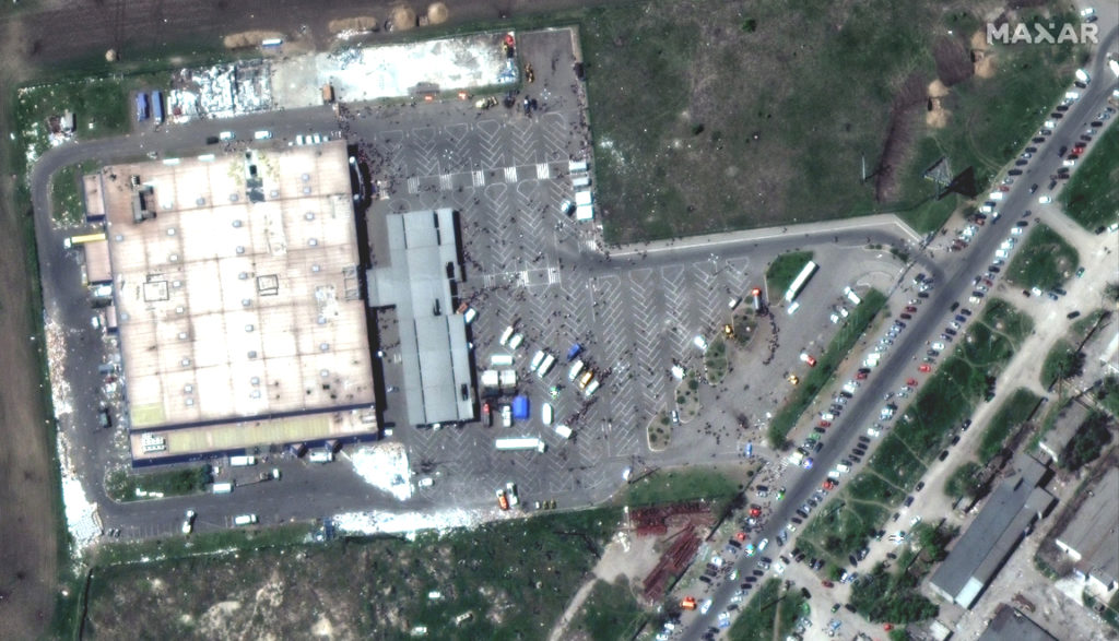
Additionally, the imagery shows activity by the Mariupol Theater (location: 47.096, 37.548), people gathered at the Metro grocery store on the western side of the city (location: 47.118, 37.503) and a continued expansion of the Starokrymske Cemetery on the western edge of the city (location: 47.139, 37.483)


All satellite imagery is ©Maxar Technologies.