• Skip to primary navigation
  • Skip to main content
  • Skip to primary sidebar
  • Skip to secondary sidebar
  • NEWS:
  • SatNews
  • SatMagazine
  • MilSatMagazine
  • SmallSat News
  • |     EVENTS:
  • SmallSat Symposium
  • Satellite Innovation
  • MilSat Symposium
  • SmallSat Europe

SatNews

  • LATEST
  • EXPLORE ⌄
    • Missions & Constellations
    • Business & Finance
    • Military & Defense
    • Launch
    • Software Automation & Ground Systems
    • Government & Regulation
    • Services & Applications
  • Magazines
  • Events
  • Jobs
  • Calendar ⌄
    • IN PERSON
    • VIRTUAL
  • Subscribe

As The Russian Barrage Of The Ukraine Continues, Maxar’s Satellite Imaging Of The War Continues

March 30, 2022

Overview and close views of downtown Mariupol showing extensive damage at and near Mariupol Theater (Location:  47.096, 37.548)

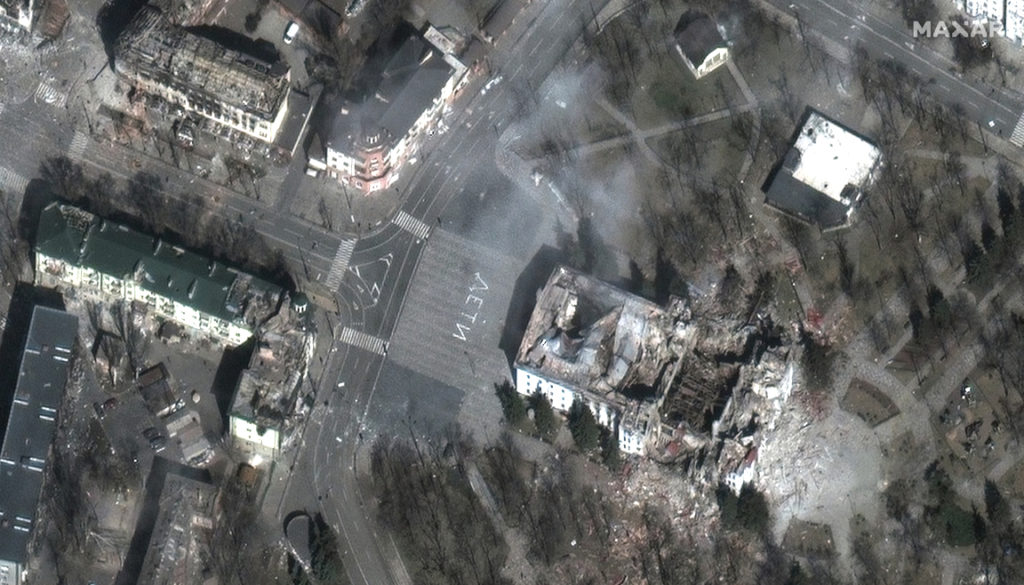
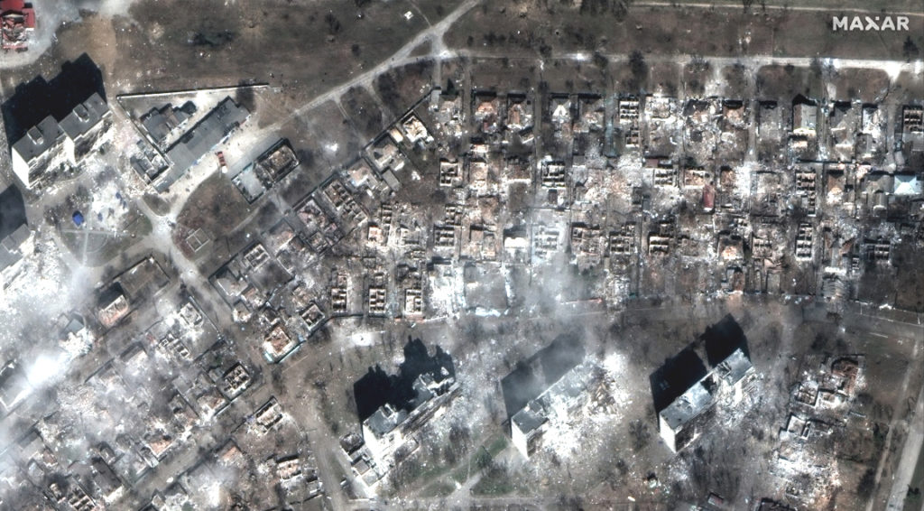
Maxar collected new high-resolution satellite imagery of Mariupol, Ukraine, on March 29th that shows extensive damage to residential apartment buildings, homes and civilian infrastructure caused by weeks of Russian artillery shelling and airstrikes.

Closer overview and views of downtown Mariupol showing extensive damage at and near Mariupol Theater (Location:  47.096, 37.548)
Before attack imagery of a residential area in Mariupol (Location: 47.094, 37.554)
After attack imagery of the same residential area in Mariupol that is shown above (Location: 47.094, 37.554)

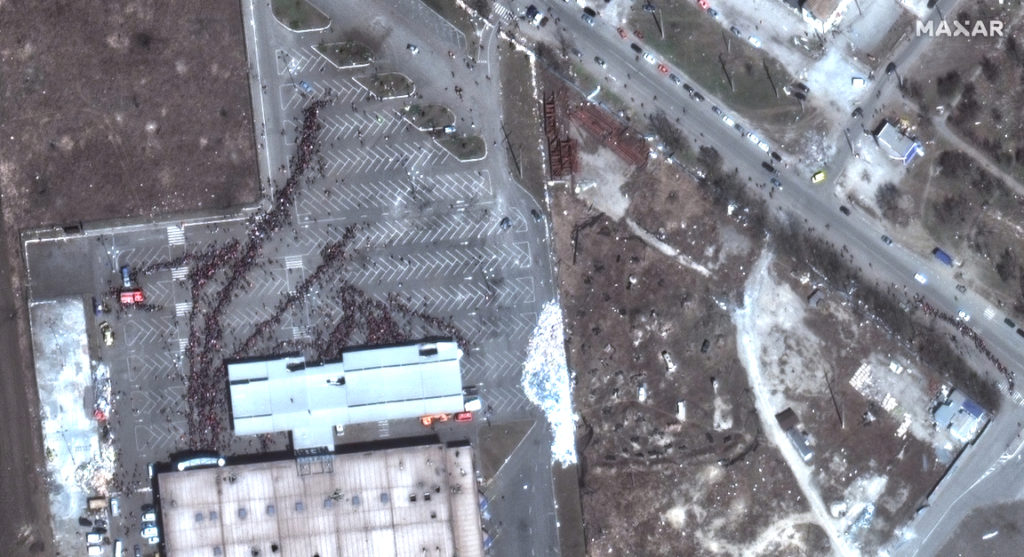
In the western part of the city, hundreds of people are seen waiting outside of a grocery store amidst reports of extreme food and water shortages.

Large crowd of people waiting for food and supplies outside of Mariupol grocery store (Location: 47.118, 37.503)
Apartment buildings and homes destroyed by shelling (Location: 47.128, 37.678)
Destruction of residential apartment buildings (Location: 47.099, 37.630)

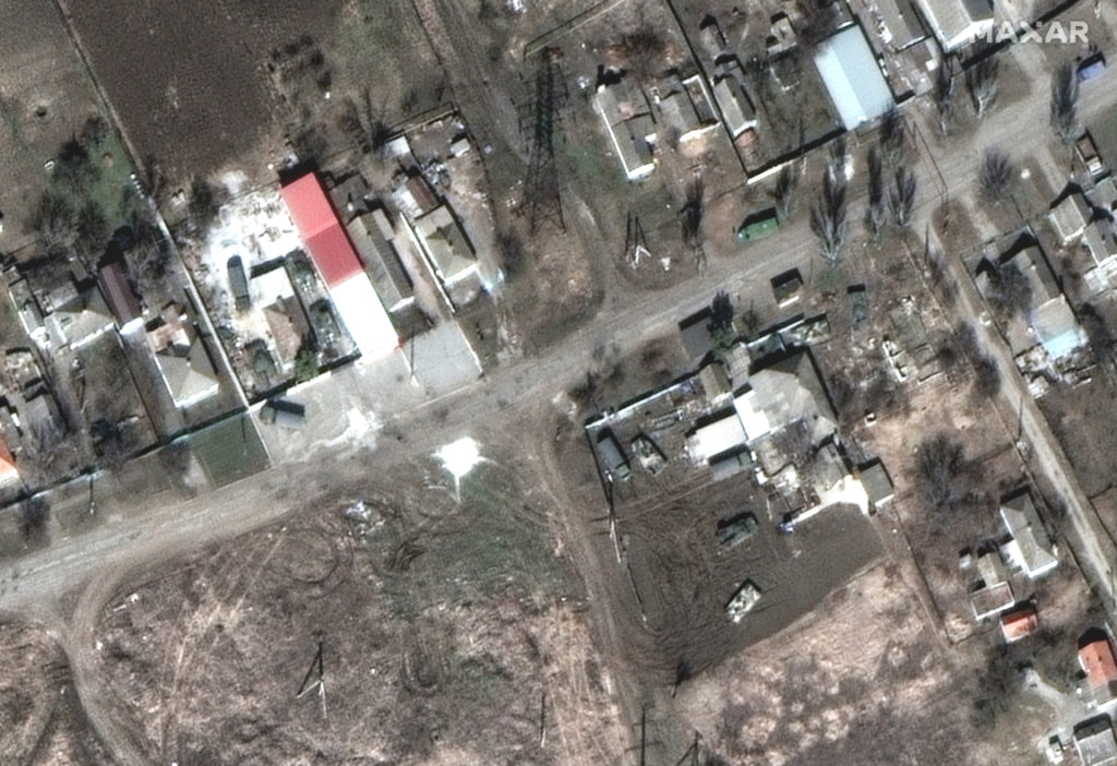
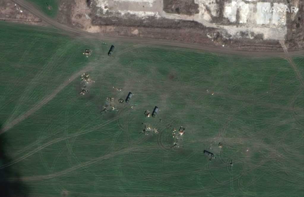
Russian troops and armored equipment, with tanks, armored vehicles and artillery are deployed in and around residential areas along the east and northeast of the city.

Tanks and armor positioned in residential area, Kalynivka—east of Mariupol (Location: 47.145, 37.665)
Towed artillery battery in firing position, Talakivka—northeast of Mariupol (Location: 47.190, 37.737)

All images are ©2022 Maxar Technologies.

Filed Under: Earth Observation & Imaging, Military & Defense Tagged With: Featured

Primary Sidebar

Coverage

  • Missions & Constellations
  • Business & Finance
  • Military & Defense
  • Launch
  • Software Automation & Ground Systems
  • Government & Regulation
  • Services & Applications

Most Read Stories

  • Russia ‘intercepts Europe's key satellites’ placing NATO satellite at risk
  • Germany boosts military space program with satellites and lasers
  • AT&T and Amazon Forge a Giant in the Skies: The Multi-Layered Strategy Behind the Kuiper-Cloud Pact
  • FCC Authorizes Logos Space to Deploy 3,960-Satellite Mega-Constellation for Enterprise Connectivity
  • Amazon Leo seeks 24-month extension from FCC due to launch shortages

About Satnews

  • Contacts
  • History

Archives

Secondary Sidebar

We use cookies to ensure that we give you the best experience on our website. If you continue to use this site we will assume that you are happy with it.
x
Sign up Now (For Free)
Access daily or weekly satellite news updates covering all aspects of the commercial and military satellite industry.
Invalid email address
Notify Me Regarding ( At least one ):
We value your privacy and will not sell or share your email or other information with any other company. You may also unsubscribe at anytime.

Click Here to see our full privacy policy.
Thanks for subscribing!