• Skip to primary navigation
  • Skip to main content
  • Skip to primary sidebar
  • Skip to secondary sidebar
  • NEWS:
  • SatNews
  • SatMagazine
  • MilSatMagazine
  • SmallSat News
  • |     EVENTS:
  • SmallSat Symposium
  • Satellite Innovation
  • MilSat Symposium

SatNews

  • HOME
  • Magazines
  • Events
  • Perspectives
  • Industry Calendar
    • IN PERSON
    • VIRTUAL
  • Subscribe

Maxar Technologies’ Continued Satellite Image Captures of the Russian-Ukrainian War

March 2, 2022

Refugees, vehicles waiting to cross into Slovakia from Ukraine; Vysne Nemecke border crossing (Location: 48.654, 22.265).

From March 1 to March 2, heavy cloud cover has blanketed Ukraine and prevented Maxar from providing new satellite imagery-based imaging opportunities of the current war. The company continues to monitor the area closely and new updates will be provided as seen as there is clear imagery to share. March 3rd appears to be the next, best date for imagery capture.

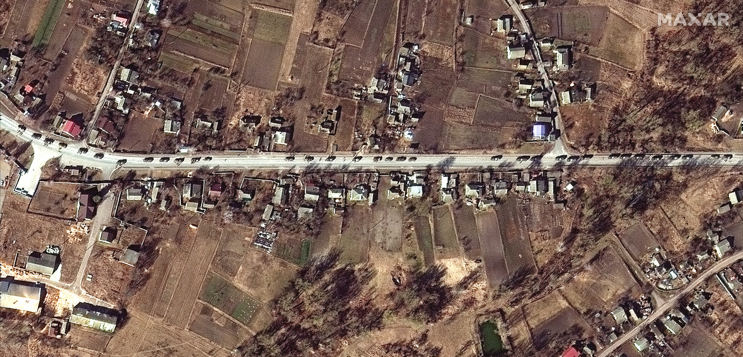
In the meantime, Maxar analyzed more of their recent satellite imagery that three of Maxar’s high-resolution satellites collected on February 28th (encompassing more than 8,000 square kilometers) and focused in on a number of Ukrainian cities and villages.

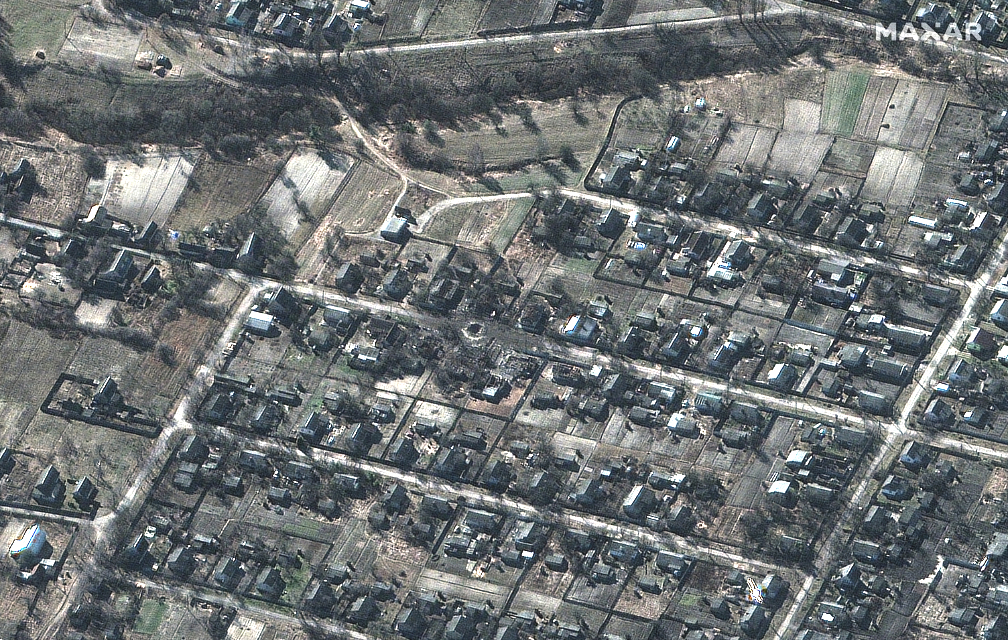
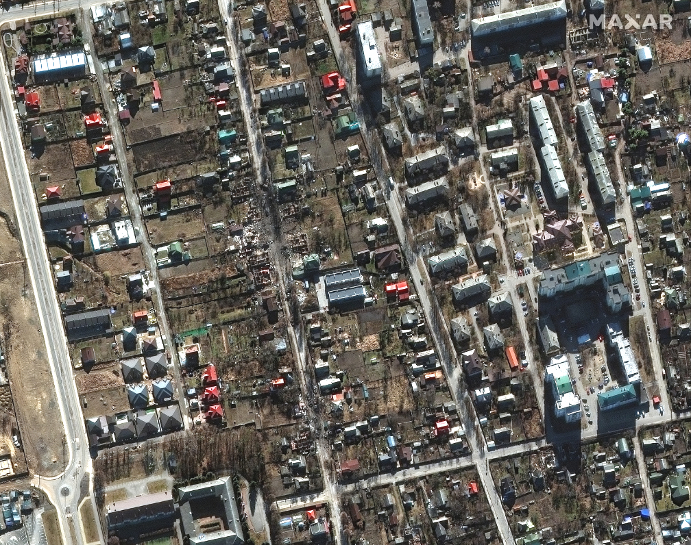
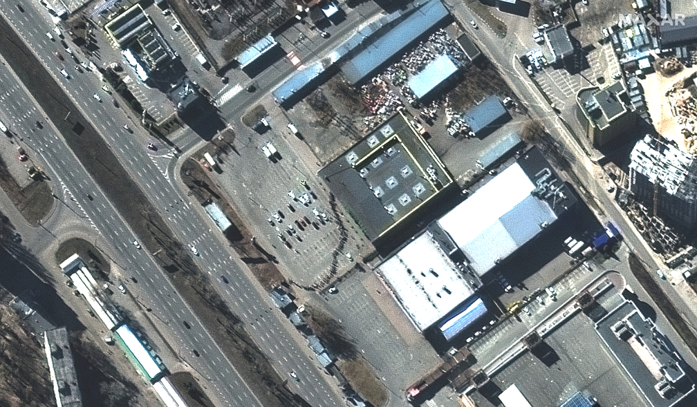
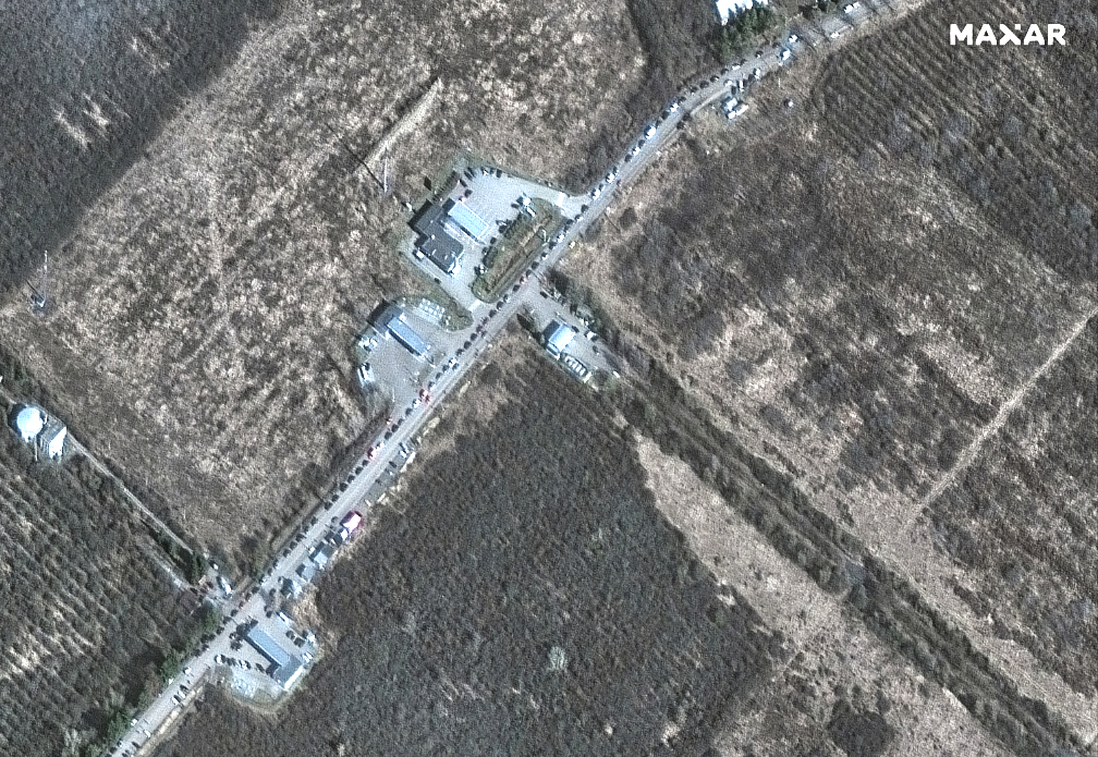
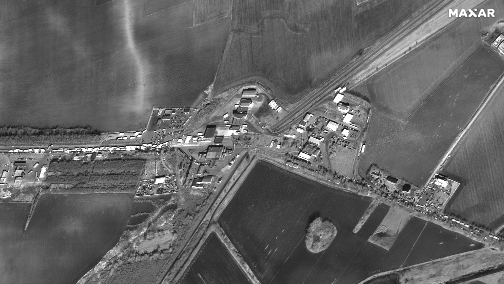
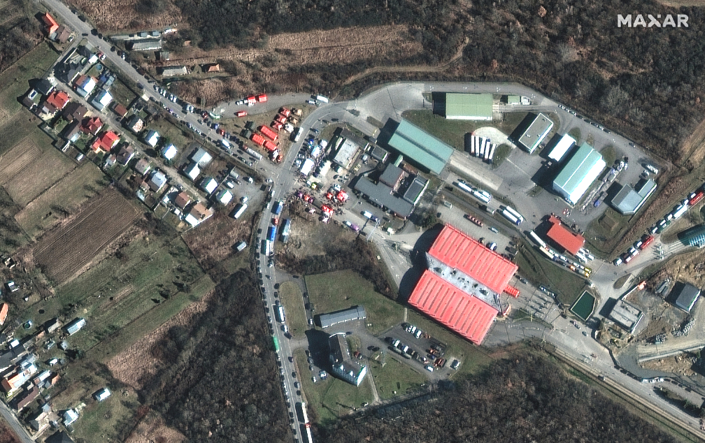
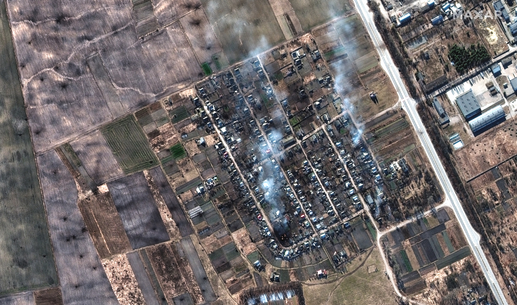
The invasion’s impact on Ukrainians was clearly evident with visual examples of damaged and destroyed homes, residential areas, buildings and factories. Long lines of people were seen waiting for food outside of supermarkets in Chernihiv and Kyiv; moreover, we witnessed people trying to leave Ukraine at multiple border crossing points and into neighboring countries including Hungary, Slovakia and Romania.

All of the imagery is copyright 2022 Maxar Technologies.

Most of the following images were collected on February 28th.

Image gallery details:

In and around Chernihiv, Ukraine, (located approximately 80 miles/130 kilometers northwest of Kyiv)
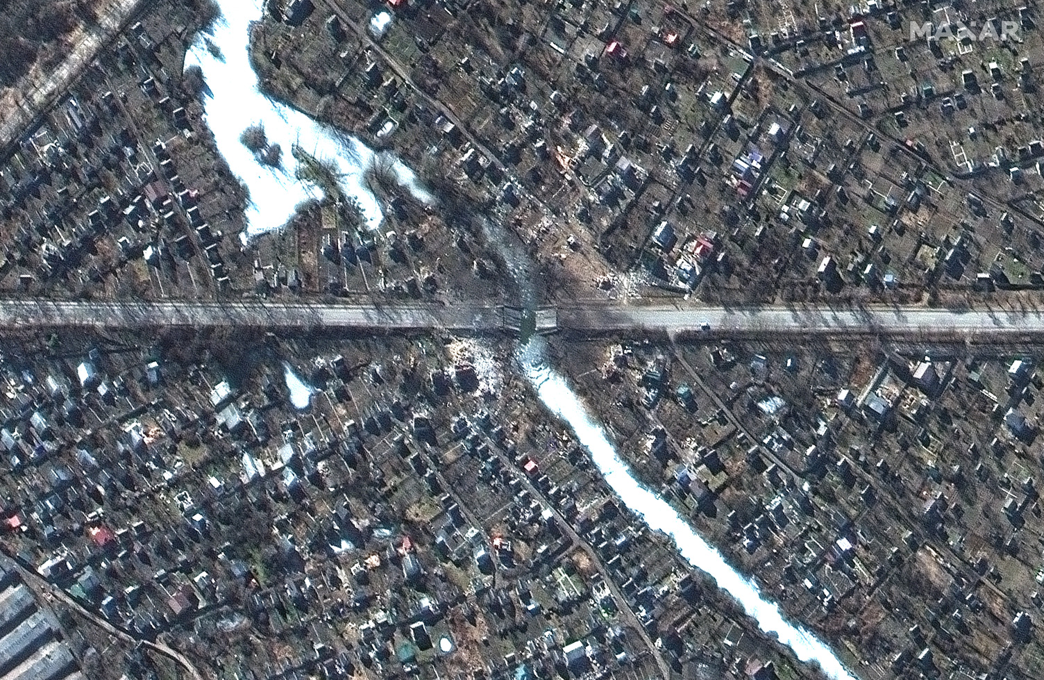
Burning homes and impact craters in fields near Rivnopillya, Ukraine (location: 51.606, 31.234)
Damaged bridge/road and nearby homes in Chernihiv.
Military convoys on western outskirts of Chernihiv (location: 51.446, 31.087).

Near Kyiv, Ukraine

Large crater in middle of residential area and destroyed homes in Sukachi village, north of Kyiv (Location: 50.966, 29.936).
Destroyed military vehicles in residential area and destroyed homes on Vokzalna Street, Bucha (western Kyiv).
Long lines of people waiting for food in Kyiv.
Refugees, cars waiting to cross into Hungary from Ukraine, Luzhanka border crossing (Location: 48.165, 22.574).
Refugees, vehicles waiting to cross into Romania from Ukraine; Siret border crossing (Location: 47.987, 26.061).

Filed Under: Geospatial, Imagery, Military, War, Warfighters Tagged With: Featured

Primary Sidebar

Most Read Stories

  • Kongsberg Defence & Aerospace Enlists NanoAvionics For Three Surveillance Satellites
  • Satellite Laser Communication System Projected To Grow To Million$$$$ By 2030
  • ESA Contracts Airbus For Further Development Of The Agency's LISA Mission
  • Rivada Space Networks Works Toward The Launch Of Their LEO Constellation
  • Miratlas Secures Million$€ In Seed Funding

About Satnews

  • Contacts
  • History

Archives

  • May 2022
  • April 2022
  • March 2022
  • February 2022
  • January 2022
  • December 2021
  • November 2021
  • October 2021
  • September 2021
  • August 2021
  • July 2021
  • June 2021
  • May 2021
  • April 2021
  • March 2021
  • February 2021
  • January 2021
  • December 2020
  • November 2020
  • October 2020
  • September 2020
  • August 2020
  • July 2020
  • June 2020
  • May 2020
  • April 2020

Secondary Sidebar

x
Sign up Now (For Free)
Access daily or weekly satellite news updates covering all aspects of the commercial and military satellite industry.
Invalid email address
Notify Me Regarding ( At least one ):
We value your privacy and will not sell or share your email or other information with any other company. You may also unsubscribe at anytime.

Click Here to see our full privacy policy.
Thanks for subscribing!