

Maxar Intelligence has engaged in a strategic partnership with Saab to jointly develop next-generation multi-domain battlespace solutions, with a specific focus on advanced space-based C5ISR systems (Command, Control, Communications, Computers, […]
Satellite Imagery
Hubble—Celebrating the space telescope’s 35th anniversary year on-orbit

In celebration of the NASA/ESA Hubble Space Telescope’s 35 years in Earth orbit, an assortment of images that were recently taken by Hubble have been released. These images stretch from […]
Satellogic EarthView dataset now openly accessible via registry of Open Data on AWS
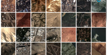
Satellogic has announced that the Satellogic EarthView dataset is now openly accessible on Amazon Web Services (AWS) cloud through the AWS Open Data Sponsorship Program. The Satellogic EarthView dataset includes […]
BlackSky wins USSF rapid procurement contracts to support TacSRT missions
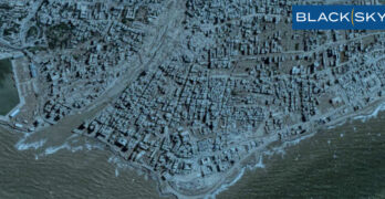
BlackSky Technology Inc. (NYSE: BKSY) has won multiple rapid procurement contracts for its high-margin, core analytics services through the U.S. Space Force’s online Global Data Marketplace (GDM) supporting a variety […]
Planet: Satellite imagery of the Los Angeles County wildfire disasters

Some of the initial Planet imagery of the Palisades and Eaton fires in Los Angeles County are published below, courtesy of Planet Labs PBC.
The best NOAA 2024 satellite imagery as selected by…

NOAA asked you to help choose the most compelling images from NOAA satellites in 2024—the 20 contenders—10 from NOAA’s GOES satellites and 10 from NOAA’s JPSS Program satellites—provided captivating, and occasionally sobering, […]
L3Harris delivers optical system to NASA for Nancy Grace Roman Space Telescope
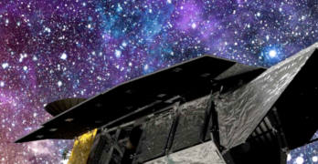
L3Harris Technologies (NYSE:LHX) has delivered the Optical Telescope Assembly (OTA) to NASA that serves as the critical “eye” for the Nancy Grace Roman Space Telescope by providing precise and stable imagery. The […]
HERE expands partnership with Maxar Intelligence to scale automated mapmaking

Maxar Intelligence has expanded their partnership with HERE Technologies to enhance the accuracy, freshness and automation of HERE’s mapmaking process. HERE has been a pioneer in digital mapping for nearly […]
Maxar + SkyWatch announce global availability of Maxar imagery on the SkyWatch platform

SkyWatch and Maxar have engaged in a multi-year agreement that enables the distribution of Maxar’s high-resolution satellite imagery to SkyWatch’s global customer base* via the SkyWatch platform. Through this partnership, SkyWatch […]
New Zealand to join Operation Olympic Defender to deter hostility and spread of debris in orbit

New Zealand has accepted an invitation to join US-led multi-national space initiative Operation Olympic Defender, Defence Minister Judith Collins announced today. Operation Olympic Defender is designed to coordinate the space […]