
Targeting the growing gap between raw satellite data and usable intelligence, Seekr announced on Wednesday the launch of SeekrGeo, a geospatial reasoning engine designed for both commercial and national security applications.
The platform debuts with a strategic licensing agreement with Wyvern, making the Canadian space-data company the inaugural partner for high-resolution hyperspectral imaging. The partnership aims to automate the complex analysis of multimodal data, allowing users to identify patterns in activity and detect environmental changes autonomously.
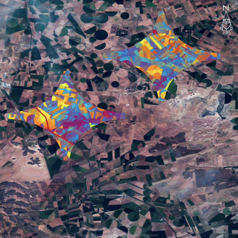
Technical Capabilities: Foundation Models Meet Hyperspectral Data
SeekrGeo is built upon a Remote Sensing Foundation Model capable of multimodal understanding and contextual reasoning. Unlike traditional computer vision models that focus solely on object detection, SeekrGeo uses Vision Language Models (VLMs) to “reason” through geospatial datasets. By integrating Wyvern’s high-resolution hyperspectral data—which captures hundreds of spectral bands beyond the visible spectrum—the engine can identify the chemical composition of materials, moisture levels in vegetation, and specific mineral signatures.
- Multimodal Synthesis: Combines hyperspectral, SAR, and optical data.
- Temporal Reasoning: Autonomous detection of activity patterns over time.
- Scalability: Designed to handle the projected $63 billion GEOINT market demand by 2030.
Rationale: Reducing Barriers to Hyperspectral Adoption
The alliance addresses a significant hurdle in the Earth Observation (EO) industry: the high technical barrier to processing hyperspectral imagery. While Wyvern’s Dragonette constellation provides best-in-class LEO data, the complexity of hyperspectral “data cubes” typically requires specialized development. The SeekrGeo integration allows customers to build applications—ranging from wildland fire management to supply chain monitoring—in a fraction of the traditional time by using AI to synthesize the raw spectral signatures into actionable reports.
Executive Perspectives on Market Integration
Chris Robson, Co-Founder and CEO of Wyvern, emphasized the efficiency of the new platform, “The biggest barrier to hyperspectral adoption has never been the data, it’s been the difficulty of turning that data into applications. Seekr’s geospatial foundation model changes the equation entirely. Instead of needing months of specialized development work, our customers will be able to build new applications in a fraction of the time at scale.”
Rob Clark, Seekr President, noted the synergy between the two firms, “Our first SeekrGeo customers required the use of Hyperspectral imaging to solve the most complex recognition problems. We recognized Wyvern for their best-in-class Hyperspectral LEO constellation and are very pleased to be working with them.”
Outlook: Expansion of the SeekrGeo Ecosystem
As SeekrGeo exits its initial beta phase, the company plans to expand its data partner ecosystem to include more diverse sensor types, including thermal and LiDAR. The long-term vision for the platform is to serve as a universal “Geospatial OS” where government agencies and enterprises can query orbital data using natural language, receiving synthesized intelligence rather than just imagery. This aligns with the broader industry trend of shifting from “images to answers,” particularly for time-critical disaster response and national security monitoring.