
ArkEdge Space Inc. has been selected for the FY2025 QZSS Utilization Demonstration Project that has been jointly organized by the Cabinet Office of Japan and Quasi-Zenith Satellite System Service Inc (QZSS).
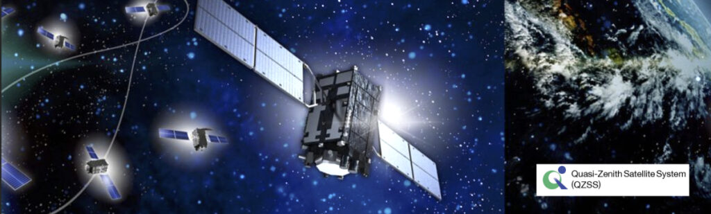
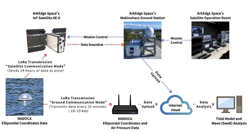
ArkEdge Space will deploy next-generation tide monitoring buoys across island nations in the Asia-Pacific region. Leveraging Multi-GNSS Advanced Orbit and Clock Augmentation for Precise Point Positioning (MADOCA-PPP), a high-precision GNSS augmentation service provided by Japan’s QZSS Michibiki, these buoys will collect sea level data and transmit it via the company’s proprietary IoT satellites.
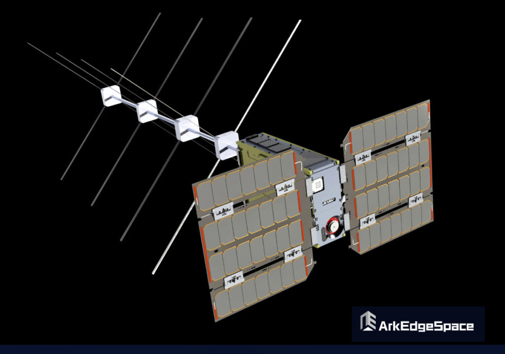
In addition to the design, development, and operation of microsatellites, ArkEdge Space is focused on the practical integration of communications technologies such as IoT and [3] VDES (VHF Data Exchange System) to enable advanced observation and positioning solutions. Through this demonstration, the company will contribute to addressing challenges in developing regions to disaster preparedness, including tsunami and storm surge monitoring, port infrastructure development, and climate change adaptation.
Field operations are scheduled to start in November of 2025, with plans to host a regional seminar at the Asia-Pacific Regional Space Agency Forum (APRSAF). A separate announcement will be made regarding buoy deployment and project updates.
Through this project, ArkEdge Space seeks to contribute to the global adoption of Japan’s satellite positioning technology Michibiki and to the advancement of sustainable marine observation infrastructure using IoT-enabled satellite services.
About the QZSS Demonstration Project
The QZSS Utilization Demonstration Project is a public initiative conducted by the Cabinet Office and Quasi-Zenith Satellite System Service Inc. to promote the early adoption of commercial services and products using Japan’s QZSS “Michibiki.”
About MADOCA-PPP
MADOCA-PPP is a real-time, high-precision positioning augmentation service developed by the Cabinet Office and Japan Aerospace Exploration Agency (JAXA). It delivers centimeter-level accuracy (≤10 cm horizontal and vertical) via the L6 signal of the Michibiki constellation and is compatible with multi-GNSS receivers.
About VDES
VDES is a next-generation maritime communication system that extends the functionality of AIS (Automatic Identification System) to enable high-speed, bidirectional data exchange. In Japan, ArkEdge Space is part of the Satellite VDES Consortium with IHI Corporation and Japan Radio Co., Ltd. (JRC). In July of 2025, the company successfully launched a test satellite and began in-orbit demonstrations of VDES technology.