
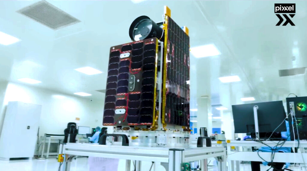
Pixxel has successfully launched the first three satellites of its Firefly constellation. The satellites were integrated via Exolaunch and launched aboard the Transporter-12 rideshare mission via SpaceX from Vandenberg Space Force Base.
This marks a significant milestone for Pixxel as it begins commercial operations, delivering critical climate and Earth insights to industries worldwide and solidifying its position as a global leader in Earth Observation.
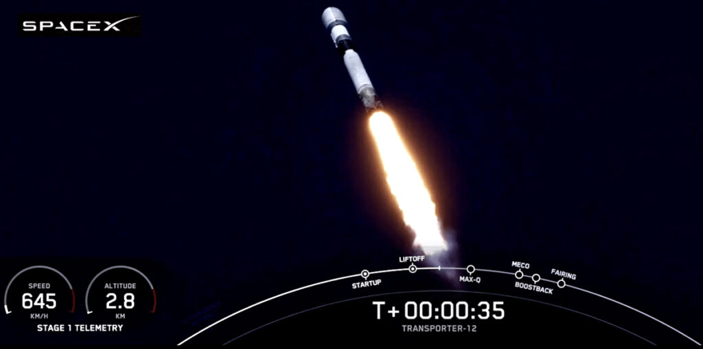
image courtesy of the company.
The Fireflies, currently the world’s highest-resolution commercial-grade hyperspectral satellites, bring unprecedented precision to monitoring the planet and setting a new benchmark for hyperspectral imaging capabilities. With an 5-meter resolution attained for the first time in a hyperspectral spacecraft, Fireflies are six times sharper than the 30-meter standard of most existing hyperspectral satellites, capturing fine details previously invisible to conventional systems.
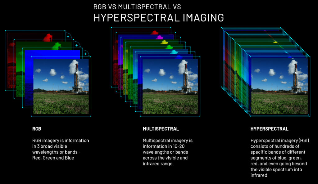
This cutting-edge resolution is paired with the ability to capture data across 150+ spectral bands, enabling Fireflies to detect subtle changes in chemical compositions, vegetation health, water quality, and even atmospheric conditions with unmatched accuracy. Unlike traditional Earth observation satellites that rely on broader spectral bands, Firefly’s narrowband sensors uncover hidden patterns and anomalies critical for applications ranging from agriculture to climate action.
Pixxel’s satellites also feature a 40-kilometer swath width and a daily revisit capability, enabling consistent monitoring of vast areas without compromising on detail and ensuring that no critical event goes unnoticed. This combination of high spatial resolution, spectral richness, and frequent global coverage positions Firefly as the world’s most advanced commercial hyperspectral imaging system.
Orbiting in a sun-synchronous orbit at roughly 550km, the Fireflies will form the cornerstone of Pixxel’s mission to build a health monitor for the planet.
“The future of our planet depends on how deeply we understand it today. The successful deployment of our first commercial satellites is a defining moment for Pixxel and a giant leap toward redefining how we use space technology to address the planet’s challenges,” said Awais Ahmed, Founder and CEO of Pixxel. “By investing in the health of our planet now, Pixxel hopes not just to shape the trajectory of Earth observation but also to help write the next chapter in the story of our shared future.”
“The Fireflies represent years of rigorous research, engineering, and innovation aimed at unlocking critical insights about our planet and are a testament to the ingenuity and dedication of our team and the transformative potential of hyperspectral imaging,” said Kshitij Khandelwal, Founder and CTO of Pixxel. “Their ability to detect subtle changes in Earth’s ecosystems will provide industries and governments with the precise information needed to address critical global challenges confidently.”
This launch marks the first phase of Pixxel’s commercial constellation, with three additional Firefly satellites scheduled to launch in Q2 2025. Together, these satellites will deliver comprehensive, real-time data collection and analysis, equipping industries and governments with insights to address global concerns, manage resources responsibly, and drive climate action.
The Firefly constellation’s advanced hyperspectral imaging capabilities open new possibilities across sectors. From empowering environmental agencies to monitor deforestation and ocean pollution in near real-time to helping industries like mining, oil, and gas enhance resource management and infrastructure safety, the applications are vast and transformative. By detecting subtle changes in soil composition, water quality, or atmospheric conditions, Firefly will change how humanity interacts with and protects our planet’s resources.
As part of its larger mission, Pixxel plans to integrate hyperspectral data with machine learning and artificial intelligence tools, further amplifying the impact of Earth Observation technology. This fusion of advanced satellite imagery and predictive analytics will enable businesses to anticipate disruptions and governments to implement proactive policies, paving the way for a new era of precision decision-making.
Pixxel has already launched three successful demo hyperspectral satellites before this launch and raised $95 million in funding, making it the most well-funded hyperspectral imaging space startup globally. With this commercial launch, Pixxel takes a decisive step toward operationalizing its vision of a hyperspectral-powered future where advanced Earth Observation drives solutions to the world’s most pressing challenges.