• Skip to primary navigation
  • Skip to main content
  • Skip to primary sidebar
  • Skip to secondary sidebar
  • NEWS:
  • SatNews
  • SatMagazine
  • MilSatMagazine
  • SmallSat News
  • |     EVENTS:
  • SmallSat Symposium
  • Satellite Innovation
  • MilSat Symposium
  • SmallSat Europe

SatNews

  • LATEST
  • EXPLORE ⌄
    • Missions & Constellations
    • Business & Finance
    • Military & Defense
    • Launch
    • Software Automation & Ground Systems
    • Government & Regulation
    • Services & Applications
  • Magazines
  • Events
  • Calendar ⌄
    • IN PERSON
    • VIRTUAL
  • Subscribe

HERE expands partnership with Maxar Intelligence to scale automated mapmaking

November 11, 2024

Maxar WorldView-3 HD image of HERE’s Chicago office on October 6, 2024.
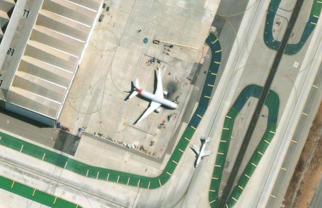
Photo is courtesy of Maxar Intelligence

Maxar Intelligence has expanded their partnership with HERE Technologies to enhance the accuracy, freshness and automation of HERE’s mapmaking process. 

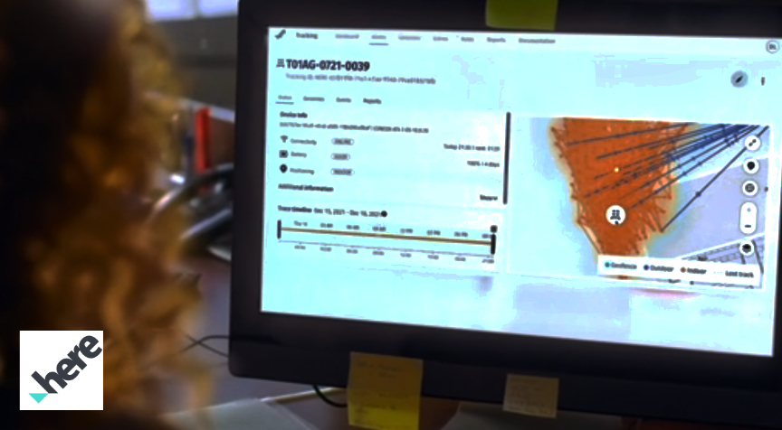
HERE has been a pioneer in digital mapping for nearly 40 years. The company has used Maxar’s satellite imagery and geospatial content products for more than 15 years. HERE employs cutting-edge, AI-powered cartography techniques to extract, ingest and conflate real-world features from diverse data sources. The integration of Maxar’s geospatial products continues to strengthen the precision and accuracy of the HERE map. 

As part of a multiyear renewed agreement, HERE has subscribed to Maxar’s Geospatial Platform (MGP) Pro for access to the most current, very high-resolution imagery collected by the Maxar constellation, as well as Maxar’s Vivid imagery basemaps. This content provides HERE with a visually consistent and highly detailed view of the Earth’s surface, supporting precise and timely updates to its maps. 

“Maxar’s satellite imagery is a key ingredient that helps us scale automated mapmaking globally,” said Jeff Raimo, Vice President of Platform Enablement at HERE Technologies. “Our partnership with Maxar over the years has enhanced the accuracy and freshness of the HERE map and location services, that are used by customers across the automotive, transportation and logistics, mobility, manufacturing and retail industries.” 

“Maxar is proud to support HERE’s mission to enable a digital representation of reality to improve the way the world moves, lives and interacts,” said Paul Granito, Maxar Intelligence’s Senior Vice President and General Manager of Enterprise. “By combining Maxar’s global, daily satellite imagery collections via MGP Pro and our Vivid basemap, HERE has critical insights for validating ground truth when producing an enterprise-grade map that offers precise navigation capabilities.” 

Filed Under: Contracts & Commercial Deals, Earth Observation & Imaging

Primary Sidebar

Coverage

  • Missions & Constellations
  • Business & Finance
  • Military & Defense
  • Launch
  • Software Automation & Ground Systems
  • Government & Regulation
  • Services & Applications

Most Read Stories

  • Proximus Global + Starlink to expand Direct-to-Cell satellite connectivity in Europe
  • Rohde & Schwarz acquires stake in Orbint GmbH for signal intelligence + reconnaissance from space
  • Congress desires LEO, but threats are real
  • FCC Opens Review for SpaceX’s 15,000-Satellite VLEO Constellation
  • USSF Awards Initial 'Golden Dome' Prototype Contracts, Signaling Strategic Shift to Space-Based Defense

About Satnews

  • Contacts
  • History

Archives

Secondary Sidebar

We use cookies to ensure that we give you the best experience on our website. If you continue to use this site we will assume that you are happy with it.
x
Sign up Now (For Free)
Access daily or weekly satellite news updates covering all aspects of the commercial and military satellite industry.
Invalid email address
Notify Me Regarding ( At least one ):
We value your privacy and will not sell or share your email or other information with any other company. You may also unsubscribe at anytime.

Click Here to see our full privacy policy.
Thanks for subscribing!