
Sceye, a leading U.S. aerospace company specializing in High-Altitude Platform Systems (HAPS), has announced a cooperating research and development agreement with United States Geological Survey (USGS) and a Space Act agreement with NASA.

The purpose of these agreements is to enhance climate and environmental imaging, monitoring, and data collection from the stratosphere. This partnership builds on Sceye’s successful 2024 flight program, which concluded with a milestone launch on October 24, 2024, demonstrating the platform’s readiness for commercialization and long-duration missions in 2025.
This collaboration positions Sceye’s HAPS technology as a critical partner in providing precise EO and lifting multi-mission payloads. Using advanced hyperspectral imaging, Sceye will help NASA and USGS detect methane “super emitters,” monitor wildfire activity, storms, earthquakes, and other extreme weather events. The partnership will help track essential environmental data and metrics in real-time and also positions Sceye to support NASA and USGS in expanding the range of climate data collection and in strengthening forecasting models.
With climate change accelerating and methane emissions at record levels, Sceye’s HAPS technology offers a solution to precisely detect emissions down to the pixel. Sceye is also collaborating with the Environmental Protection Agency (EPA) and the New Mexico Environmental Department on a five-year program to detect methane emissions across the state. Sceye’s last flight of the year demonstrates the platform’s operational readiness by capturing essential data through onboard infrared cameras.
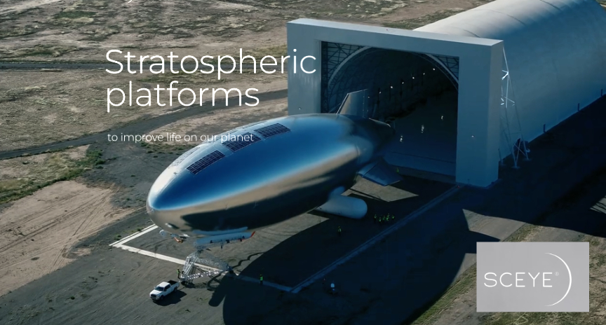
Sceye’s HAPS are powered by solar energy captured during daylight and stored in batteries to operate throughout the night. This enables continuous flight above 60,000 feet, where few technologies can operate effectively.
The final flight successfully captured the largest real-time map of New Mexico to date. The flight’s high-resolution, multi-gigabit images stitched together offer unprecedented precision and scale for disaster prevention and environmental monitoring. This technical achievement lays the groundwork for expanded commercial applications in 2025.
With a focus on commercialization and endurance, Sceye will transition to testing the platform’s capacity to sustain long-duration “seasonal flights” in 2025. These missions will enable continuous monitoring during critical periods like wildfire season, supporting rapid response efforts with near real-time data on evolving threats.
Following a successful Series C round that raised the company’s pre-money valuation to $525 million, Sceye is advancing its mission to create world-changing solutions.
The final launch of Sceye’s 2024 flight program completed a successful flight year and the full characterization of the vehicle, including achieving the important milestones of controlled relocation, full diurnal flight, and the ability to stay over an area of operation for long periods of time.
“Our partnership with NASA and USGS is built on the potential of HAPS to stay over an area of operation for long periods of time. In contrast to satellites, HAPS can do that below orbital altitude, thereby offering a unique vantage point to address climate change and better prepare for extreme weather events,” said Mikkel Vestergaard Frandsen, CEO and Founder of Sceye. “We are unlocking the stratosphere as the next frontier to make important scientific advancements that will help communities across the world.”
“HAPS are a game changer for the scientific community because they can linger over events, take high resolution data continuously in real time, and give a more accurate understanding of what may happen before, during, and after an event,” said Jonathan Stock, Director, USGS National Innovation Center.
About Sceye
Founded in 2014, Sceye is an aerospace company dedicated to advancing stratospheric technology to connect people and protect the planet. Sceye leads the High-Altitude Platform Systems (HAPS) industry, focusing on universal connectivity, climate monitoring, natural resource management, and disaster prevention.