
Digital Earth Africa has launched their Waterbodies Monitoring Service — this service is a world-first developed in – and for – the African continent.
The service is unique among satellite-based global surface water datasets given the accessible and operational nature of the data, and the focus on providing timely, relevant and interpretable information to decision makers.
The Digital Earth Africa Waterbodies Monitoring Service has pushed the boundaries of how satellite Earth Observation (EO) data can be packaged, accessed, and analyzed to assess and monitor surface water across the entire African continent.
Digital Earth Africa, the world’s largest operator of the Open Data Cube (ODC) infrastructure, is a free platform for accessing satellite imagery specific to the African continent, which is also hosted on the continent. By packaging EO data into accessible and free data sets, African governments, industry players, and decision-makers, can track changes across the continent in unprecedented detail.
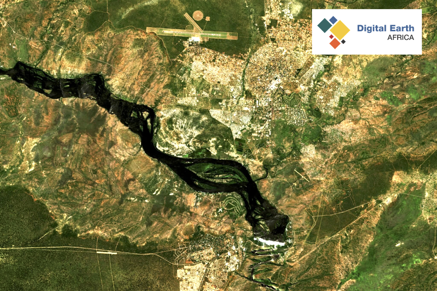
The Waterbodies Monitoring Service identifies more than 700,000 unique water bodies across Africa, incorporating more than 40 years of satellite observations. Updated on a weekly basis, the service maps persistent and seasonal waterbodies and the changes in the surface area of water in each of these over time. Waterbodies includes lakes, ponds, man-made reservoirs, wetlands, and segments of river systems.
Several key functionalities set the Digital Earth Africa Waterbodies Monitoring Service apart from other global datasets. Importantly, the service provides waterbodies statistics for every country on the African continent, and is updated weekly with the most recent satellite measurements.
While other datasets have provided important information on the presence or absence of surface water, the Digital Earth Africa Waterbodies Monitoring Service takes this a step further by providing the actual surface extent, along with the wet surface area, as a time series for each individual waterbody.
Dr. Lisa-Maria Rebelo, the Lead Scientist at Digital Earth Africa, said, “The Digital Earth Africa science team interrogated what the optimal waterbodies datasets might look like in terms of addressing user defined needs, and delivering the most impact, considering both where the current gaps were in existing waterbodies datasets, and how to ensure increased interoperability for users. The outcome is a robust service, co-designed with Digital Earth Africa users, that provides highly detailed and far-reaching information (both current and retrospective) on the continent’s waterbodies. The service is accessible via the Digital Earth Africa interactive maps platform (https://apo-opa.co/3KDzjy3) and the sandbox analytical environment (https://apo-opa.co/3RoHTo4) – and this is standard across all Digital Earth Africa products and services. However, for the Waterbodies Monitoring Service, the company introduced an API to ensure that service providers and product developers could directly integrate these data into their work, thereby creating customized queries around water body extents, historical wet surface area, and changes related to these.”
By way of example, a user could request data on all waterbodies in a particular area, as well as the wet surface area time series for each of those waterbodies. From this, powerful and highly customized summaries can be created to allow the close monitoring of an individual waterbody, or to understand trends and the latest status of a collection of waterbodies.
Rebelo highlights that, while the Digital Earth Africa Waterbodies Monitoring Service is groundbreaking in terms of accessibility, interoperability and transparency, the service’s full potential is with its application. This includes providing detailed understanding of surface water availability, dry season access to water, changes in water body sizes over time, and an understanding of potential flood risks.
Over the next few months, the Digital Earth Africa team will be seeking feedback from users engaged in real-world applications of the Waterbodies Monitoring Service.
Rebelo said, “The service has been developed to support Africa’s governments, policymakers, and key private sector actors in undertaking insightful planning, adopting critical risk mitigation strategies, and proactively managing Africa’s settlements, cities, communities, and livelihood activities which are dependent on, or adjacent to waterbodies.”