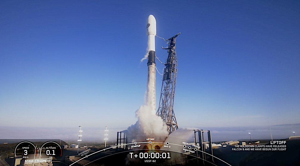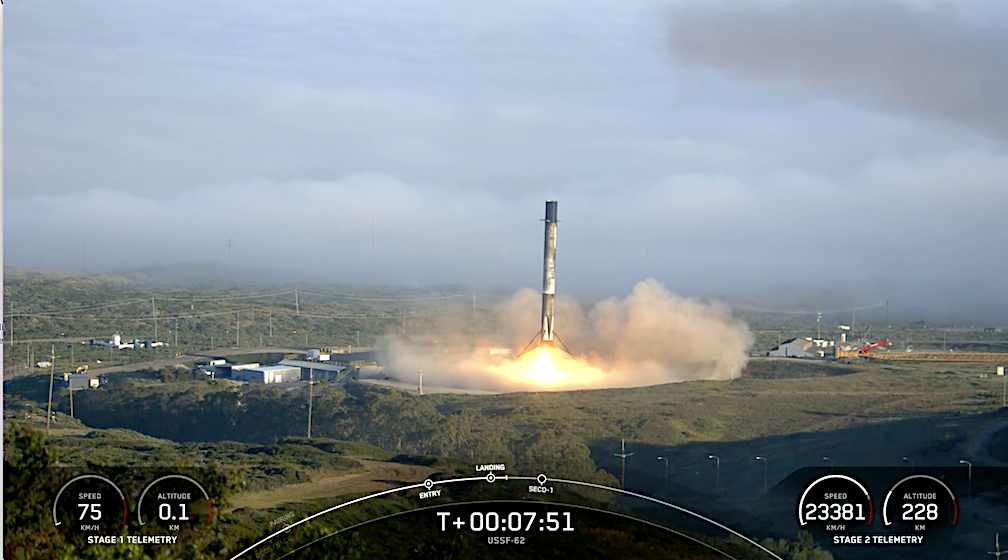
Photo by Satnews captured from SpaceX video stream
On Thursday, April 11 at 7:25 a.m. PT, Falcon 9 launched the USSF-62 mission to low-Earth orbit from Space Launch Complex 4 East (SLC-4E) at Vandenberg Space Force Base in California.

This is the third launch of the first stage booster supporting this mission, which previously launched two Starlink missions. Following stage separation, the first stage landed on Landing Zone 4 (LZ-4) at Vandenberg Space Force Base.

“Vandenberg Guardians and Airmen play a critical role in enabling launch operations and delivering critical space capabilities to orbit,” said U.S. Space Force Col. Mark Shoemaker, Space Launch Delta 30 commander. “The mission of the Space Force is to secure our Nation’s interests in, from, and to space. Our Space Launch Delta 30 team is committed to excellence in the “to” part of that mission.”
The U.S. Space Force’s West Coast Spaceport will enable the launch of WSF-M, which will aid in modernizing space-based environmental monitoring systems.
The WSF-M satellite will provide U.S. and Allied warfighters with essential weather data, including the measurement of ocean surface wind speed and direction, ice thickness, snow depth, soil moisture, and local spacecraft Energetic Charged Particle environment. The data gathered by WSF-M will be provided to meteorologists in support of the generation of a wide variety of weather products necessary to conduct mission planning and operations globally.
Vandenberg SFB is the U.S. Space Force’s west coast spaceport and test range. Vandenberg is one of only two high-capacity spaceports for the United States, providing strategic space access capabilities that deliver on-orbit systems for global space operations. Guardians and Airmen have enabled more than 2060 launches from the Vandenberg spaceport to date.
SpaceX’s Thursday DoD’s USSF-62 Weather System Follow-on–Microwave mission

SpaceX is targeting Thursday, April 11 for Falcon 9’s launch of the USSF-62 mission to low-Earth orbit from Space Launch Complex 4 East (SLC-4E) at Vandenberg Space Force Base in California. The approximate 10-minute launch window opens at 7:25 a.m. PT. If needed, a backup opportunity is available Friday, April 12 with the same launch window.
A live webcast of this mission will begin on X @SpaceX about 15 minutes prior to liftoff. Watch live.
The Weather System Follow-on–Microwave (WSF-M) represents the next-generation operational environmental satellite system for the Department of Defense, providing critical and actionable environmental intelligence to military operations in all warfighting domains.
Designed to address three high-priority space-based environmental monitoring (SBEM) requirements, WSF-M will ultimately mitigate six existing SBEM gaps:

| High Priority SBEM Gap | Additional SBEM Gaps |
| Ocean surface vector winds | Sea ice characterization |
| Tropical cyclone intensity | Soil moisture |
| LEO energetic charged particle characterization | Snow depth |
This will be the third launch of the first stage booster supporting this mission, which previously launched two Starlink missions. Following stage separation, the first stage will land on Landing Zone 4 (LZ-4) at Vandenberg Space Force Base.
As the prime contractor for the WSF-M mission, BAE Systems is responsible for developing and integrating the entire system, including the instrument, spacecraft and ground system software.

At the heart of the WSF payload is the Microwave Imager (MWI) sensor that takes calibrated passive radiometric measurements at multiple microwave frequencies to determine sea surface winds, tropical cyclone intensity and additional environmental data. In addition, a government-provided Energetic Charged Particle (ECP) sensor will provide space weather measurements.
As the prime contractor for the WSF-M mission, BAE Systems is responsible for developing and integrating the entire system, including the instrument and spacecraft. More importantly, WSF-M will broadcast real-time and actionable environmental intelligence to military operations in all warfighter domains.
The WSF-M bus is based on the configurable platform, a proven, agile spacecraft with 50 years of on-orbit operations for affordable remote sensing applications. The low Earth orbit (LEO) space vehicle is capable of sensing, storing, and transmitting microwave raw sensor data to enable derivation of ocean surface vector wind (OSVW), tropical cyclone intensity (TCI), snow depth, soil moisture and sea ice characterization.
