

Escalating tensions in the South China Sea lead to closer international cooperation.
In the volatile arena of the South China Sea, tensions between the Philippines and China continue to escalate, with recent developments indicating a growing concern for maritime security in the region.
The Philippines has announced a strategic move to enhance its ability to monitor and respond to Chinese vessels employing the controversial tactic of “going dark” in its territorial waters.
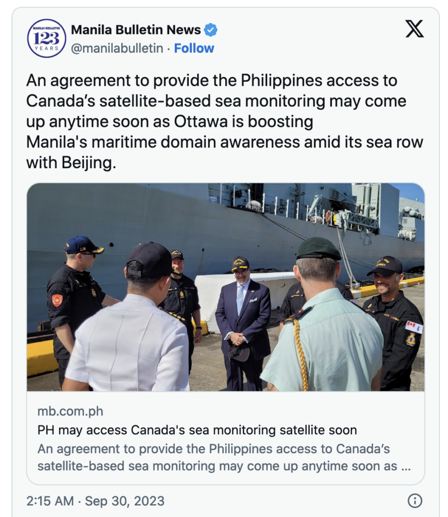
Ottawa’s Ambassador to Manila, David Hartman, unveiled this initiative during a press briefing aboard HMS Vancouver, a Canadian warship, on a friendly visit to the archipelago.
The Challenge of Tracking ‘Dark’ Vessels and Their Covert Tactics
Ambassador Hartman told reporters the crucial role Canadian satellites will play in detecting and tracking vessels that switch off their Automatic Information System (AIS) transponders to evade detection.
AIS is a globally recognized signaling system mandated by the International Maritime Organization (IMO) for identifying a vessel’s type, position, course, speed, and other navigation safety information.
The act of “going dark” refers to the practice of disabling these transponders to operate covertly, a tactic frequently employed by Chinese coast guard and maritime militia vessels.
Safeguarding Philippine Interests Amidst Escalating Tensions
This initiative marks a significant step forward for the Philippines in safeguarding its territorial waters and fisheries.
Don McLain Gill, a Manila-based geopolitical analyst, underscored the importance of this cooperation, explaining to EurAsian Times how “[s]uch forms of cooperation benefit the Philippines given its interest in improving its ability to track and trace vessels that indulge in illegal fishing within its Exclusive Economic Zone (EEZ).”
Gill said that this proactive approach will allow the country to manage its precious marine resources more efficiently, ensuring their sustainable use for future generations, as well as safeguarding the interests of Filipino fishermen, who depend on these waters for their livelihoods.
The Enigma of China’s Coast Guard Ships
The recent escalation in tensions was exemplified by a standoff involving a small Philippine resupply vessel and six China Coast Guard ships. During this incident, only one of the Chinese ships had its AIS active throughout the engagement, while two others intermittently transmitted AIS signals. Three Chinese Coast Guard ships remained in “dark” mode throughout the confrontation, highlighting the deliberate use of this tactic to maintain the element of surprise.Read Next: Shangri-La Sh owdown: Austin Says China Undermines Security in Indo-Pacific, Beijing Fires Back
One vessel, in particular, stood out – the shadowy China Coast Guard ship numbered 5201, notorious for seldom activating its AIS transmitter. Even when it did, it typically utilized a counterfeit identification number (412000008) shared by numerous other Chinese vessels.
Analysts argued that the absence of adverse weather conditions during such incidents dispelled any claims that extreme weather hindered AIS transmission.
Tactics and Strategies in the South China Sea
The utilization of AIS transponder manipulation is not an isolated event; it has been recurrently observed during incidents involving the Second Thomas Shoal (also known as Ayungin Shoal) resupply missions and provocations against the Philippine Coast Guard.
On February 6, 2023, a Chinese Coast Guard vessel harassed a Philippine Coast Guard ship using a bright green laser, or “dazzler.” Such tactics are indicative of China’s assertive posture in disputed waters.

China has demonstrated its readiness to both disable and enable AIS transponders as a means of asserting its jurisdiction. For instance, in the oil and gas fields off Vietnam’s southeastern coast, the Chinese Coast Guard frequently toggles their transmitters while patrolling near Vanguard Bank.
International Response to South China Sea Tensions
This strategic maneuver by the Philippines to enlist Canadian satellite assistance is part of a broader international response to Chinese aggression in the South China Sea.
Canada recalibrated its Indo-Pacific strategy last month, aligning itself with the Philippines to counter these aggressive postures.
A Canadian Halifax-class frigate is presently stationed in the Philippines, participating in the archipelago’s annual maritime drills with the US, aptly named “Sama-Sama” (All Together), which began on October 2 and will continue until October 13 in southern Luzon.
In addition to Canada, like-minded nations such as Japan, Australia, and the United Kingdom have joined the maritime drills, with New Zealand and Indonesia observing the exercises. This international participation underscores the significance of the South China Sea issue on the global stage.
Persistent Territorial Disputes and China’s Expanding Claims
The confrontations between the Philippine and Chinese coast guards in the South China Sea have persisted, with both nations asserting their territorial claims.
Recent incidents include the removal of a Chinese-installed floating barrier near the disputed Scarborough Shoal by Filipino forces. This shoal falls within the Philippines’ 200-nautical-mile EEZ as defined by international maritime law, a ruling affirmed by The Hague’s International Court of Arbitration.
Canada’s joint patrol with the Philippines in the South China Sea in September demonstrated the commitment of both nations to assert their rights in the region.
Despite a 2016 arbitral tribunal ruling in favor of the Philippines, China continues to assert claims and undertake military and economic activities in the region. This includes the construction of artificial islands in the West Philippine Sea housing military bases with ports and air bases.
A Ten-Dash Line and Ongoing Maritime Concerns
China’s expansive territorial claims, notably its “nine-dash line,” have extended to a “ten-dash line,” further escalating tensions in the South China Sea.
The presence of People’s Armed Forces Maritime Militia and China Coast Guard vessels shadowing or harassing Philippine vessels remains a persistent concern.

As the Philippines fortifies its capabilities to monitor vessels going “dark” in its waters with the assistance of Canadian satellites, the international community watches closely, hoping to maintain stability and peace in the highly contested South China Sea. The Philippines’ determination to protect its sovereignty and resources sets a precedent for other nations facing similar challenges in the region.
This article is from SFROP