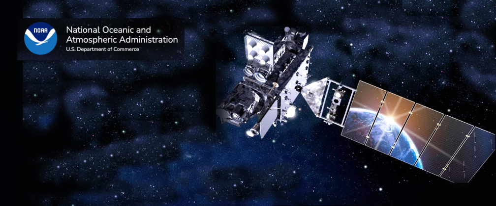
NOAA has declared the Geostationary Operational Environmental Satellite (GOES)-18 fully operational as GOES West, marking a significant milestone for severe weather detection in the Western Hemisphere.
Launched on March 1, 2022, the primary instrument aboard GOES-18 is the L3Harris high-resolution, Advanced Baseline Imager (ABI). L3Harris also produced the enterprise ground system which processes the imagery and controls the weather satellite constellation and its suite of instruments.
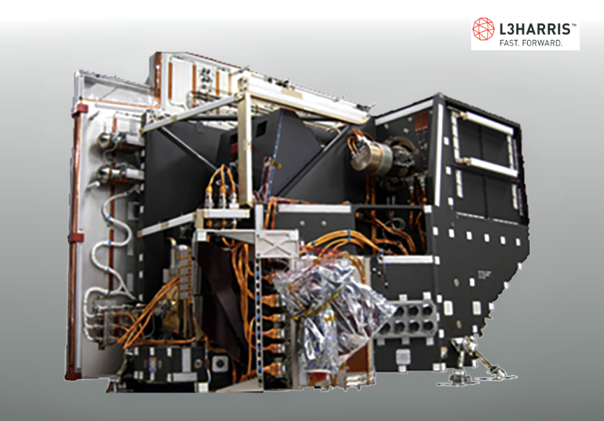
The ABI views Earth with 16 spectral bands and provides three times more spectral information, four times the spatial resolution, and more than five times faster coverage than the previous generation imager. The ABI onboard GOES-18 provides critical weather data on the western contiguous U.S., Hawaii, Alaska, Mexico, Central America and the Pacific.
The final satellite in the GOES-R series of advanced geostationary weather sensors, GOES-U, is slated to launch in 2024 and features L3Harris’ fourth ABI. NOAA’s next-generation geostationary satellite mission, Geostationary Extended Observations (GeoXO), will begin operating in the early 2030s and the imager award is expected to be announced in early 2023.
“The declaration of GOES-18 as fully operational reinforces our relentless pursuit to build a more weather-ready nation,” said Rob Mitrevski, Vice President and General Manager, Spectral Solutions, Space and Airborne Systems, L3Harris. “As a long-standing and trusted partner to NOAA, we have successfully delivered more than 75 payloads in 60 years and are proud of the significant role our technology is playing to help detect future severe weather events.”
GOES West info from NOAA…
GOES-18 replaces GOES-17 as GOES West, located 22,236 miles above the equator over the Pacific Ocean. GOES-17 will become an on-orbit standby.
In its new role, GOES WEST will serve as NOAA’s primary geostationary satellite for detecting and monitoring Pacific hurricanes, atmospheric rivers, coastal fog, wildfires, volcanic eruptions, and other environmental phenomena that affect the western contiguous United States, Alaska, Hawaii, Mexico, and Central America.
The satellite delivers high-resolution visible and infrared imagery, atmospheric measurements, and real-time mapping of lightning activity. It is ideally located to monitor the northeastern Pacific Ocean, where many weather systems that affect the continental U.S. originate. GOES-18 also watches the sun and detects approaching space weather hazards.
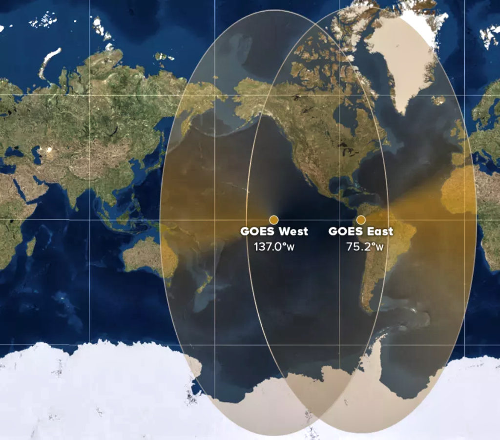
GOES West joins GOES East (GOES-16) in operational service. Together, the two satellites watch over more than half the globe, from the west coast of Africa to New Zealand and from near the Arctic Circle to the Antarctic Circle. Their data assists weather forecasters, emergency managers, first responders, the aviation and shipping industries, and more.
While GOES WEST has just officially entered operational service, the satellite has been assisting NOAA National Weather Service forecasters for months. Usually, GOES satellites complete post-launch testing in a location over the central U.S., but this satellite’s early successes allowed NOAA to move it to its future operational location early. GOES WEST began sending imagery from its new location in June.
Due to an issue with the cooling system on GOES-17’s Advanced Baseline Imager (ABI) instrument, some GOES-17 imagery was degraded during certain times of the year. In August, NOAA implemented a unique solution to mitigate the loss of some GOES-17 imagery during these “warm” periods. From August 1 to September 8, and from October 13 to November 16, NOAA provided data from the GOES-18 ABI to GOES West data users. This was accomplished through a data “interleave” that delivered GOES-18 ABI data alongside GOES-17 lightning mapper and space weather data. This allowed forecasters to use GOES-18 imagery during the height of the Pacific hurricane season.
Now that GOES-18 is operating as GOES West, GOES-17 will be moved to a central location between GOES East and GOES West to serve as a backup for the operational constellation.
The GOES-R Series Program is a four-satellite mission that includes GOES-R (GOES-16, launched in 2016), GOES-S (GOES-17, launched in 2018), GOES-T (GOES-18), and GOES-U, which is scheduled to launch in 2024. The program is a collaborative effort between NOAA and NASA. NASA builds and launches the satellites for NOAA, which operates them and distributes their data to users worldwide.
GOES-R Series satellites are planned to operate into the 2030s. NOAA and NASA have already begun work on the next-generation geostationary mission called Geostationary Extended Observations (GeoXO). The Department of Commerce formally approved the GeoXO Program on Dec. 14, 2022. GeoXO will continue observations provided by GOES-R and bring new capabilities to address our changing planet and the evolving needs of NOAA’s data users.