
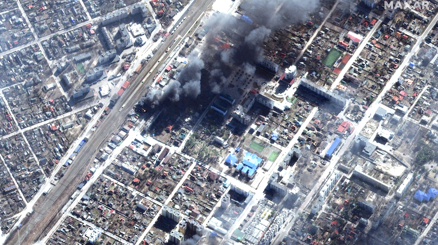
Satellites owned by private companies have played an unexpectedly important role in the war in Ukraine. For example, in early August 2022, images from the private satellite company Planet Labs showed that a recent attack on a Russian military base in Crimea caused more damage than Russia had suggested in public reports. Ukrainian President Volodymyr Zelenskyy highlighted the losses as evidence of Ukraine’s progress in the war.
Soon after the war began, Ukraine requested data from private satellite companies around the world. By the end of April, Ukraine was getting imagery from U.S. companies mere minutes after the data was collected.
My research focuses on international cooperation in satellite Earth observations, including the role of the private sector. While experts have long known that satellite imagery is useful during a conflict, the war in Ukraine has shown that commercial satellite data can make a decisive difference—informing both military planning as well as the public view of a war. Based on the strategic value commercial satellite imagery has held during this war, I believe it is likely that more nations will be investing in private satellite companies.
Growth of the commercial satellite sector
Remote-sensing satellites circle the Earth collecting imagery, radio signals and many other types of data. The technology was originally developed by governments for military reconnaissance, weather forecasting and environmental monitoring. But over the past two decades, commercial activity in this area has grown rapidly—particularly in the U.S. The number of commercial Earth observation satellites has increased from 11 in 2006 to more than 500 in 2022, about 350 of which belong to U.S. companies.
The earliest commercial satellite remote-sensing companies worked closely with the military from the beginning, but many of the newer entrants were not developed with national security applications in mind. Planet Labs, the U.S.-based company that has played a big role in the Ukrainian conflict, describes its customers as those in “agriculture, government, and commercial mapping,” and it hopes to expand to “insurance, commodities, and finance.” Spire, another U.S. company, was originally focused on monitoring weather and tracking commercial maritime activity. However, when the U.S. government set up pilot programs in 2016 to evaluate the value of data from these companies, many of the companies welcomed this new source of revenue.
Value of commercial data for national security
The U.S. government has its own highly capable network of spy satellites, so partnerships with private companies may come as a surprise, but there are clear reasons the U.S. government benefits from these arrangements.
First is the simple fact that purchasing commercial data allows the government to see more locations on the Earth more frequently. In some cases, data is now available quickly enough to enable real-time decision-making on the battlefield.
The second reason has to do with data sharing practices. Sharing data from spy satellites requires officials to go through a complex declassification process. It also risks revealing information about classified satellite capabilities. Neither of these is a concern with data from private companies. This aspect makes it easier for the military to share satellite information within the U.S. government as well as with U.S. allies. This advantage has proved to be a key factor for the war in Ukraine.
The remainder of this article can be found here Fast Company
By Mariel Borowitz is an associate professor of international affairs at the Georgia Institute of Technology.