
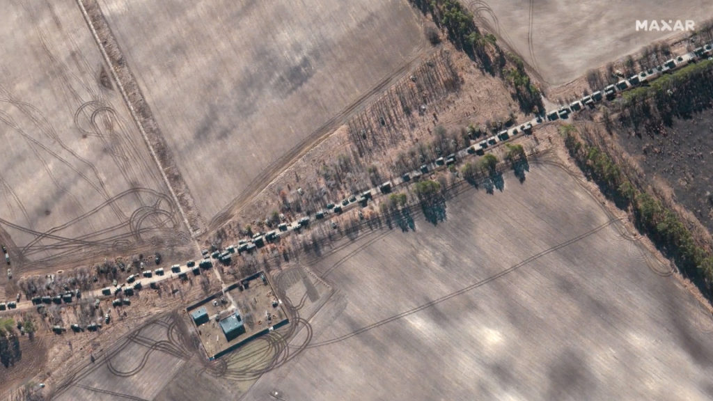
On Monday, February 28th, Maxar distributed high-resolution satellite images of the Russian military convoy that covered approximately 40 miles in an area northwest of Kyiv, Ukraine.
That imagery was produced from the more than 1,400 sq. km. of imagery that Maxar’s WorldView-3 satellite collected over the convoy area in a single orbital pass on February 28th.
While Maxar waits for the next clear-weather opportunity to collect new imagery, the company has produced a 3D video to provide a better visual way to understand the scope and magnitude of the convoy (which is otherwise difficult to convey by looking at only a few individual images).
The video, which includes sections of the convoy but not the entire 40-mile length, was created by geo-registering Maxar’s February 28th WorldView-3 satellite imagery on top of its Precision3D model of the Kyiv area. This data has an absolute accuracy in all directions of 3 meters, which means that objects seen in the video are physically within that 3 meters zone in the real-world.
This unique view, created with space-based data, allows viewers to have a better understanding of the on-the-ground situation when the area is not readily accessible.
Note in the video that you can see military vehicles and equipment in convoy along the road, positioned along the tree lines and parked in farmland and fields.
Link to 3-minute video for b-roll

Link to 1–minute clip from longer video
Learn more about Maxar’s 3D capabilities at this direct link…
Videos are copyright 2022 Maxar Technologies