
Carbon Mapper, a new nonprofit organization, and its partners – the State of California, NASA’s Jet Propulsion Laboratory (NASA JPL), Planet, the University of Arizona, Arizona State University (ASU), High Tide Foundation and RMI – have announced a pioneering program to help improve understanding of, and accelerate reductions in, global methane and carbon dioxide (CO2) emissions.
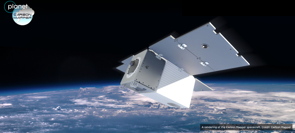
The Carbon Mapper consortium also announced its plan to deploy a ground-breaking hyperspectral satellite constellation with the ability to pinpoint, quantify and track point-source methane and CO2 emissions.
As the window to limit global warming narrows, there is an urgent need to deploy new technologies that can quickly and accurately measure greenhouse gas emissions across the globe. Current approaches to measure methane and CO2 emissions at the scale of individual facilities – particularly intermittent activity – present challenges especially in terms of transparency, accuracy, scalability and cost. In short, if you can’t measure it, you can’t manage it.
Carbon Mapper will help overcome these technological barriers and enable accelerated action by making high emitting methane and CO2 sources publicly visible and at the facility level quickly and persistently. The data collected by the Carbon Mapper constellation of satellites will provide more complete, precise, and timely measurement of point source methane and CO2 source level emissions as well as 25+ other environmental indicators.
Carbon Mapper, in collaboration with its public and private partners, is developing the satellite constellation in three phases. The initial study phase is complete and included two years of preliminary engineering development and manufacturing.
Phase 1 is underway and includes development of the first two satellites by Planet and NASA JPL, planned to launch in 2023, accompanying data processing platforms, and ongoing cooperative methane mitigation pilot projects using aircraft in California and other US states.
Phase 2, which is in development, would encompass the expansion to an operational multi-satellite constellation starting in 2025.
Carbon Mapper, in collaboration with California’s Air Resources Board (CARB), is also developing a public portal to make the data available for use by industry, governments, and private citizens to improve greenhouse gas accounting, expedite repair of leaks, support disaster response, and improve environmental resilience.
Powered by philanthropy, Carbon Mapper convenes a unique coalition of private and public sector actors with the combined expertise and resources to deploy a science-driven, sustained and operational decision support service for maximum impact.
- NASA JPL will deliver the hyperspectral imaging spectrometer payload for the first Carbon Mapper satellite, leveraging advanced remote sensing technology with many years of heritage on aircraft and spacecraft. JPL will also provide technical assistance to Planet’s development of the payload for the additional satellites. These spectrometers offer unparalleled sensitivity, resolution, and versatility.
- Planet, operator of Earth imaging satellites, will design and build the satellites – leveraging the hyperspectral imaging sensor from NASA JPL – and operate the fleet with its existing missions system architecture. Planet will further contribute its rapid revisit satellites, data, and analytics technologies to deliver and pinpoint methane emission for governments, private and public institutions, citizens, facility operators and more. Planet’s ability to commercialize data products is key to the buildout and continuity of the multi-satellite constellation.
- California Air Resources Board (CARB) maintains policy leadership and a pioneering approach to understanding and taking action to reduce climate pollutants and exposure in communities impacted by air pollution. CARB is already working with University of Arizona, JPL, and ASU to use airborne prototypes of Carbon Mapper to demonstrate mitigation and improved accounting with facility operators across California.
- High Tide Foundation has led the extensive philanthropic investment in Carbon Mapper through which they are seeking to deliver on their goal to have a significant measurable impact on climate change mitigation.
- The University of Arizona offers scientific leadership of the methane and CO2 emissions data delivery, including developing new algorithms and analytic frameworks and testing them with an ongoing airborne research program. The University also provides key staff and other resources to the Carbon Mapper non-profit.
- Arizona State University (ASU) provides scientific leadership for non-methane and CO2 data products and supports Planet’s efforts to develop new environmental indicators on the land and in the oceans. ASU’s Global Airborne Observatory is also critical for Carbon Mapper’s airborne prototyping and field campaigns.
- RMI helps guide methane use case applications for Carbon Mapper, satellite observation targeting, industry mitigation opportunities, and policy development through its Oil and Gas Solutions Initiative.
- Bloomberg Philanthropies, one of the original funders of Satellites for Climate Action, believes access to accurate data is one of the most powerful tools we have in tackling the climate crisis. This partnership builds on Bloomberg Philanthropies’ environmental portfolio, which has a long track record of bringing data and transparency solutions to the fight against climate change, including initiatives such as the Bloomberg Global Coal Countdown.
Carbon Mapper is setting out to contribute to the growing community of organizations offering science-based guidance to decision makers at all levels of society and builds on Satellites for Climate Action, an initiative launched in 2019 to bring together governments, philanthropists, environmental groups, and technology companies to use satellite technologies to monitor greenhouse gas emissions and turn satellite data into actionable information.
Carbon Mapper is supported by funding from a group of leading philanthropists: High Tide Foundation, Grantham Foundation for Protection of the Environment, Bloomberg Philanthropies, Zegar Family Foundation, other philanthropic donors, and the University of Arizona.
“This decade represents an all-hands-on-deck moment for humanity to make critical progress in addressing climate change,” said Riley Duren, Carbon Mapper CEO and research scientist at the University of Arizona. “Our mission is to help fill gaps in the emerging global ecosystem of methane and CO2 monitoring systems by delivering data that’s timely, actionable and accessible for science-based decision making.”
“The Carbon Mapper consortium is a novel multi-stakeholder partnership where each actor is an expert in their own domain that allows for us to do more than we can alone,” said Robbie Schingler, Planet co-founder and Chief Strategy Officer. “Planet is proud to be the commercial and technology partner to deliver needed data for climate action while accelerating humanity toward a more efficient, sustainable global economy.”
“What makes Carbon Mapper unique is that it greatly expands both methane and CO2 emissions transparency for decision makers and civil society,” said RMI Senior Fellow Deborah Gordon. “RMI can use Carbon Mapper to help certify low-methane natural gas and make emissions visible to accelerate action on a global scale.”
“These satellites will help California identify and reduce methane emissions from industrial and energy sources, and also provides valuable data to help us manage our natural and working lands for climate resiliency,” stated CARB Executive Officer Richard Corey. “CARB looks forward to providing a public platform for the greenhouse gas data and exploring how the land-use data can inform decisions on forest management, fire prevention and water quality.”
“High Tide led the funding effort for Carbon Mapper to catalyze low-cost mitigation of greenhouse gases, by creating an innovative partnership model to identify dangerous leaks of methane (CH₄) and carbon dioxide (CO2 ). Carbon Mapper is uniquely positioned to maximize the impact of philanthropic dollars,” noted Richard Lawrence, Founder and Director of High Tide Foundation.