
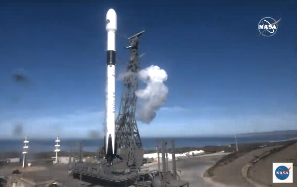
At 18:17 (09:17 US Pacific time) on November 21, 2020, the Copernicus Sentinel-6 Michael Freilich ocean-monitoring satellite was successfully launched on a SpaceX Falcon 9 rocket from the Vandenberg Air Force base in California.
The mission will continue the unbroken, almost three-decades-long, high-precision measurements of Earth’s oceans from space which provide crucial information about sea level rise and are critical inputs for weather forecasting.
The satellite is named after the late Dr. Michael Freilich, who was Director of NASA’s Earth Science Division and a champion of science and international cooperation.

EUMETSAT will take over operations of the spacecraft in three days’ time and will be responsible for routine operations and processing and disseminating its altimetry data.
EUMETSAT operates the geostationary satellites Meteosat -9, -10 and -11 over Europe and Africa, and Meteosat-8 over the Indian Ocean.
EUMETSAT operates three Metop polar-orbiting satellites as part of the Initial Joint Polar System (IJPS) shared with the US National Oceanic and Atmospheric Administration (NOAA). The organization is also a partner in the cooperative, sea level monitoring Jason missions (Jason-3 and Jason-CS/Sentinel-6) involving Europe and the United States.
The data and products from EUMETSAT’s satellites are vital to weather forecasting and make a significant contribution to the monitoring of environment and climate change.
Executive Comments

The European Commission’s Director-General for Defence Industry and Space, Mr. Timo Pesonen, said, “We are very pleased to welcome this newcomer to the EU’s fleet of Copernicus Sentinel satellites. Copernicus Sentinel-6 Michael Freilich will enable delivery of enhanced products and information concerning the oceans and the atmosphere to improve the daily lives of our citizens. The arrival of this satellite is another success for Copernicus, for Europe, for all mission partners and worldwide.”

EUMETSAT Director-General Alain Ratier said, “With this launch, EUMETSAT will continue its contribution to high-precision ocean altimetry missions, which started with Jason-2. Our responsibility has increased with the Copernicus Sentinel-6 mission, as we developed the ground segment and will perform flight operations. The EUMETSAT teams are ready to take over control of the spacecraft from ESA, three days after launch, and to start processing the first data. Sentinel 6 Michael Freilich data will expand the unique record of mean sea level, whilst improving it and providing measurements closer to the coastline and of unprecedented accuracy. . The data will improve forecasts of high-impact weather and climate features that are strongly influenced by the ocean, like heat waves, tropical cyclones and unusually warm or cold summers and winters.” Ratier added that the mission continues the exemplary cooperation between the US and Europe that began with the launch of TOPEX-Poseidon in 1992.

Dr. Steve Volz, Assistant Administrator of the US National Oceanic and Atmospheric Administration’s (NOAA) Satellite and Information Service, added, “NOAA will use Sentinel-6 data in many ways, including using sea levels to estimate the heat stored in the upper layer of the ocean, which will help improve hurricane intensity forecasts.“

Thomas Zurbuchen, NASA’s Associate Administrator for Science at the agency’s headquarters in Washington, said Dr ,Freilich helped ensure NASA was a steadfast partner with scientists and space agencies worldwide. “His love of oceanography and Earth science helped us improve the understanding of our beautiful planet. This satellite, so graciously named for him by our European partners, will carry out the critical work Mike so believed in – adding to a legacy of crucial data about our oceans and paying it forward for the benefit of future generations.”

The European Space Agency’s (ESA) Director of Earth Observation Programs, Josef Aschbacher, noted, “I’m extremely proud to have seen Copernicus Sentinel-6 lift off this evening and know that it’s well on its way to starting its mission of continuing the measurements of sea-level that are so needed to understand and monitor the worrying trend of rising seas. I would not only like to thank the ESA teams that have worked so hard to get to this point, but also the European Commission, EUMETSAT, NASA, NOAA and CNES, and, of course, we very much look forward to further fruitful cooperation between our respective organizations.”
The European Organisation for the Exploitation of Meteorological Satellites is an intergovernmental organisation based in Darmstadt, Germany, currently with 30 Member States (Austria, Belgium, Bulgaria, Croatia, Czech Republic, Denmark, Estonia, Finland, France, Germany, Greece, Hungary, Iceland, Ireland, Italy, Latvia, Lithuania, Luxembourg, the Netherlands, Norway, Poland, Portugal, Romania, Slovakia, Slovenia, Spain, Sweden, Switzerland, Turkey and the United Kingdom).
The European Union has entrusted EUMETSAT with exploiting the four Sentinel missions of the Copernicus space component dedicated to the monitoring of atmosphere, ocean and climate on its behalf. EUMETSAT carries out these tasks in cooperation with ESA and already exploits the Sentinel-3 marine mission.
EUMETSAT has established cooperation with operators of Earth Observation satellites from Europe and China, India, Japan, Russia, South Korea and the United States.