• Skip to primary navigation
  • Skip to main content
  • Skip to primary sidebar
  • Skip to secondary sidebar
  • NEWS:
  • SatNews
  • SatMagazine
  • MilSatMagazine
  • SmallSat News
  • |     EVENTS:
  • SmallSat Symposium
  • Satellite Innovation
  • MilSat Symposium

SatNews

  • HOME
  • Magazines
  • Events
  • Perspectives
  • Industry Calendar
    • IN PERSON
    • VIRTUAL
  • Subscribe

PCI Geomatics’ Geomatica Banff Offers New Features and Full ICEYE SAR Sensor Support

August 5, 2020

PCI Geomatics‘ Geomatica Banff is improved with new features and enhancements as well as full support for data from ICEYE’s constellation of SAR satellites. PCI Geomatics develops remote sensing and photogrammetry software.

Leading the list of new capabilities and enhancements are: 

  1. Super Registration: Resolve issues with inaccurate ortho-images by aligning all types of geocoded imagery to 1/10th of a pixel accuracy.
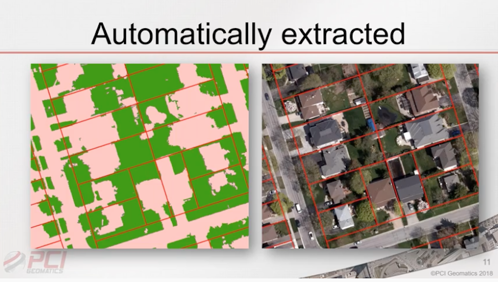
  2. Automated Object-based Classification: End-to-end automation of your supervised object-based classification workflow in Python.
  3. InSAR performance boost: Significantly reduce the time required to perform phase unwrapping using a multi-look approach.

Geomatica Banff now offers full support of ICEYE’s state-of-the-art constellation of commercial SAR sensors with the objective of providing daily interferometry anywhere on Earth at 1m and 3m resolutions.
 
Kevin Jones, Vice President of Product and Marketing for PCI Geomatics said, “By supporting ICEYE’s VHR SAR data with near-daily revisit times, our user-community can now leverage Geomatica’s powerful InSAR capabilities on data that is ideal for continuous monitoring applications.”

The Highlights, New Features, and Updated items are all listed here.

Filed Under: Earth Observation (EO), New Products

Primary Sidebar

Most Read Stories

  • CORRECTION: Blue Origin launches their 5th human spaceflight mission
  • neXat empowers affordable satellite internet for Indonesian businesses 
  • Satellogic is a finalist for “Company Award 2022” by the European Association of Remote Sensing Companies
  • SES and Vodafone PNG to deliver 4G and 5G services to underserved areas in Papua New Guinea
  • neXat interconnects with Eutelsat ADVANCE network resulting in wider coverage and better flexibility for ISPs

About Satnews

  • Contacts
  • History

Archives

  • July 2022
  • June 2022
  • May 2022
  • April 2022
  • March 2022
  • February 2022
  • January 2022
  • December 2021
  • November 2021
  • October 2021
  • September 2021
  • August 2021
  • July 2021
  • June 2021
  • May 2021
  • April 2021
  • March 2021
  • February 2021
  • January 2021
  • December 2020
  • November 2020
  • October 2020
  • September 2020
  • August 2020
  • July 2020
  • June 2020
  • May 2020
  • April 2020

Secondary Sidebar

x
Sign up Now (For Free)
Access daily or weekly satellite news updates covering all aspects of the commercial and military satellite industry.
Invalid email address
Notify Me Regarding ( At least one ):
We value your privacy and will not sell or share your email or other information with any other company. You may also unsubscribe at anytime.

Click Here to see our full privacy policy.
Thanks for subscribing!