
• Skip to primary navigation
  • Skip to main content
  • Skip to primary sidebar
  • Skip to secondary sidebar
  • NEWS:
  • SatNews
  • SatMagazine
  • MilSatMagazine
  • SmallSat News
  • |     EVENTS:
  • SmallSat Symposium
  • Satellite Innovation
  • MilSat Symposium

SatNews

  • HOME
  • Magazines
  • Events
  • Perspectives
  • Industry Calendar
    • IN PERSON
    • VIRTUAL
  • Subscribe

Planet Data Assists the Copernicus Emergency Management Service

June 12, 2020


Planet’s Dove smallsats.
Image is courtesy of the company.

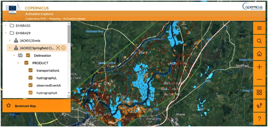
The Copernicus Emergency Management Service, or Copernicus EMS, uses Planet data to help provide emergency response mapping services for a variety of disaster situations, ranging from geophysical and meteorological hazards to humanitarian and man-made crises.

When events occur, authorized users can alert Copernicus EMS to an emergency location, and the service provides satellite-derived products for quick and effective response. It also provides information that can aid in disaster preparedness, prevention and recovery.

Copernicus EMS is managed by the European Commission and operated by the Joint Research Centre of the European Commission. The European Space Agency (ESA) is responsible for providing satellite data for the requested products, both from Sentinel missions and from commercial data providers. Planet and ESA entered into an agreement allowing ESA to access both PlanetScope and SkySat as one of the Copernicus Contributing Missions—with the aim of combining Planet data with information gleaned from Sentinel satellites.

As Copernicus EMS has access to Planet’s SkySat constellation—which will have increased rapid revisit capabilities due to the upcoming launch of more SkySats—the service is able to provide governments and other organizations with critical geospatial information within hours or days of a disaster, charting changes in near-real time. With access to Planet’s extensive PlanetScope and SkySat imagery archive, Copernicus EMS is also able to supply organizations with imagery of a location before an event occurs. This allows the service to provide risk and recovery maps and an early warning and monitoring component, which includes support in case of droughts, wildfires and floods.

The service connects decision-makers with the critical geoinformation they need, empowering them to assess situations with more clarity and make educated decisions.
 

Filed Under: News

Primary Sidebar

Most Read Stories

  • CORRECTION: Blue Origin launches their 5th human spaceflight mission
  • neXat empowers affordable satellite internet for Indonesian businesses 
  • Satellogic is a finalist for “Company Award 2022” by the European Association of Remote Sensing Companies
  • UPDATE 6: Lunar Transfer Orbit achieved by Rocket Lab for the NASA CAPSTONE smallsat — 1st deep space mission success for the company
  • SES and Vodafone PNG to deliver 4G and 5G services to underserved areas in Papua New Guinea

About Satnews

  • Contacts
  • History

Archives

  • July 2022
  • June 2022
  • May 2022
  • April 2022
  • March 2022
  • February 2022
  • January 2022
  • December 2021
  • November 2021
  • October 2021
  • September 2021
  • August 2021
  • July 2021
  • June 2021
  • May 2021
  • April 2021
  • March 2021
  • February 2021
  • January 2021
  • December 2020
  • November 2020
  • October 2020
  • September 2020
  • August 2020
  • July 2020
  • June 2020
  • May 2020
  • April 2020

Secondary Sidebar

x
Sign up Now (For Free)
Access daily or weekly satellite news updates covering all aspects of the commercial and military satellite industry.
Invalid email address
Notify Me Regarding ( At least one ):
We value your privacy and will not sell or share your email or other information with any other company. You may also unsubscribe at anytime.

Click Here to see our full privacy policy.
Thanks for subscribing!