• Skip to primary navigation
  • Skip to main content
  • Skip to primary sidebar
  • Skip to secondary sidebar
  • NEWS:
  • SatNews
  • SatMagazine
  • MilSatMagazine
  • SmallSat News
  • |     EVENTS:
  • SmallSat Symposium
  • Satellite Innovation
  • MilSat Symposium

SatNews

  • HOME
  • Magazines
  • Events
  • Perspectives
  • Industry Calendar
    • IN PERSON
    • VIRTUAL
  • Subscribe

Maxar Continues To Capture Satellite Imagery Of The Russian-Ukraine Invasion

March 21, 2022

Two image captures above: Overviews of Mariupol with burning buildings from ongoing artillery shelling (Note: includes 19 March and 21 March images. Location: 47.096, 37.547)

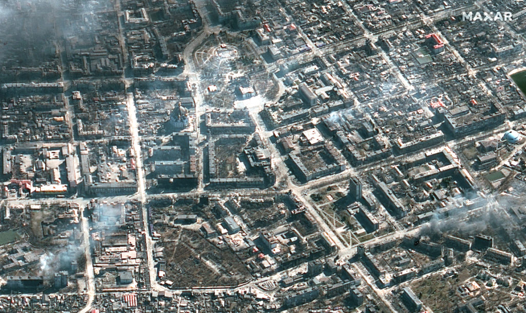
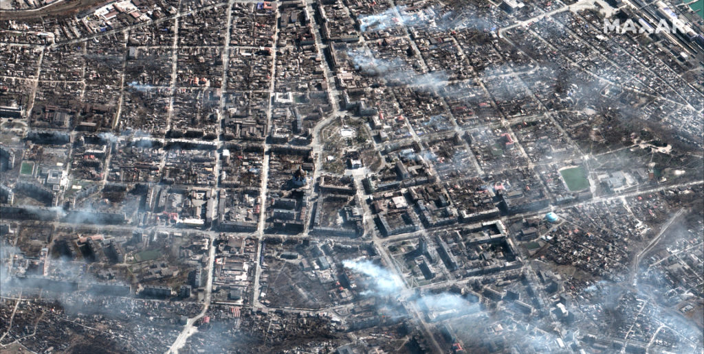
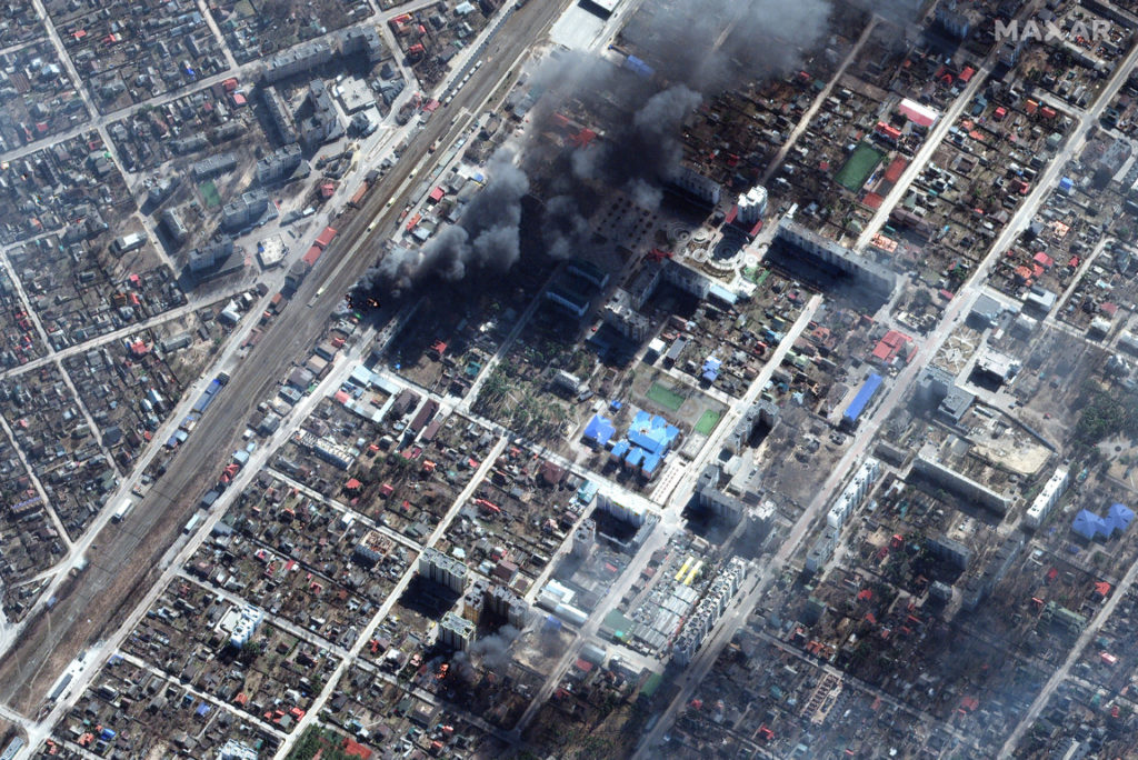
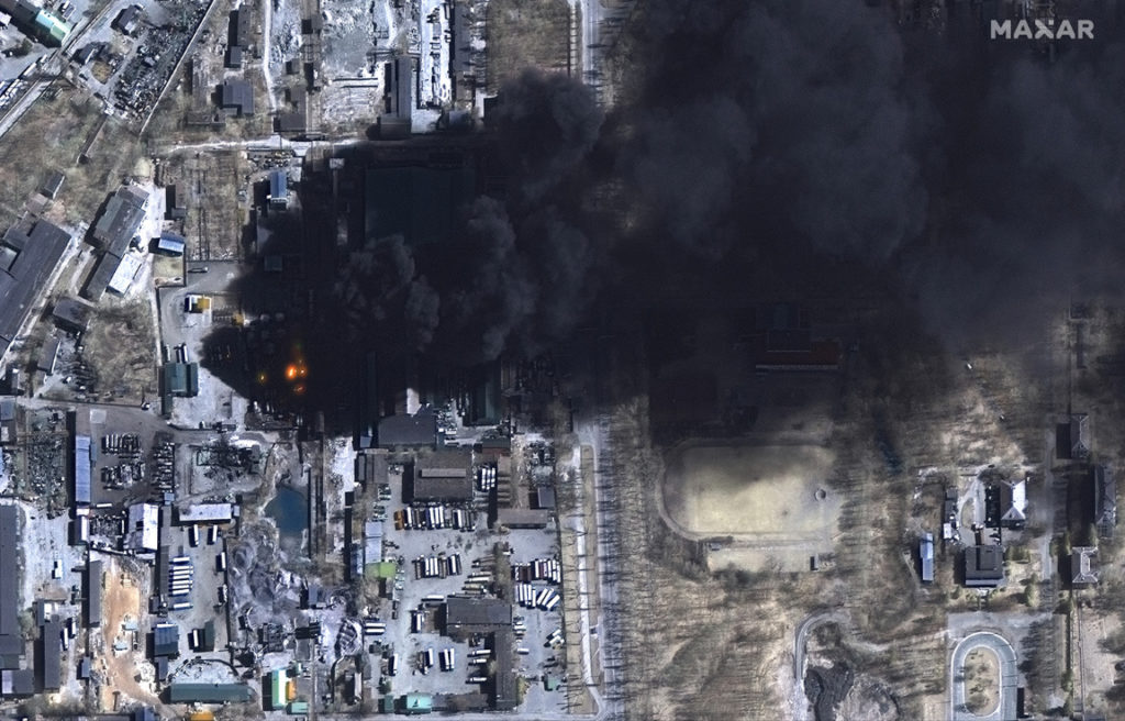
New Maxar satellite imagery collected March 18 to March 21, 2022, reveals continued Russian military activity in and around a number of key Ukrainian cities that include Mariupol, Kyiv and Chernihiv.

Examples of Russian artillery deployed northeast of Mariupol near Talakivka  (Location: 47.188, 37.735)

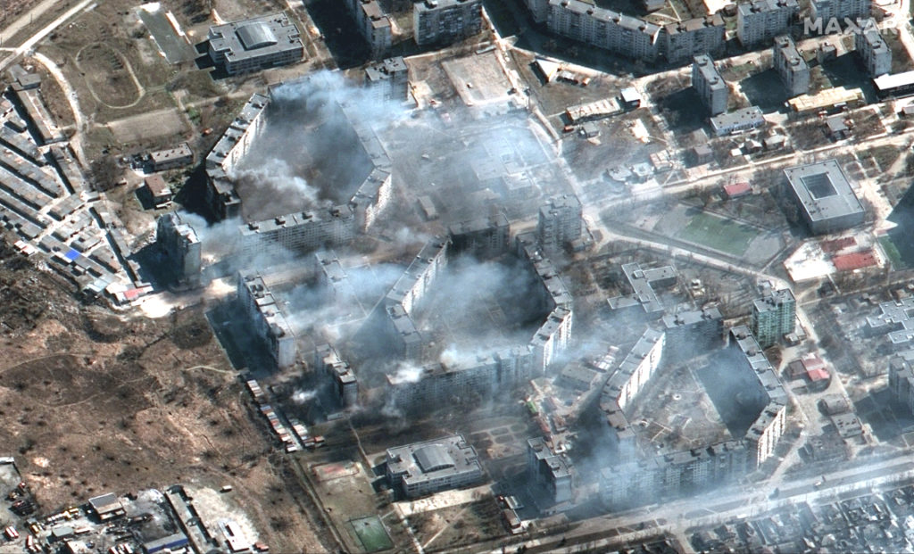
Artillery forces remain deployed around each of these three cities and they continue to fire on civilian areas with widespread damage seen to residential buildings, industrial areas and infrastructure.

Burning apartment buildings likely shelled by artillery, burning buildings, Mariupol region (Location: 47.125, 37.683)
Russian tanks and armored vehicles in streets of Mariupol (Location: 47.101, 37.650)
Burning and damaged buildings near train station, Irpin (Locations: 50.522, 30.246 and 50.536, 30.258)
Multispectral images of burning storage tanks and damage in industrial area, Chernihiv (Location: 51.470, 31.242)

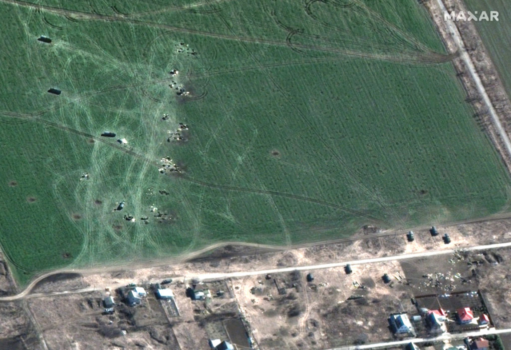
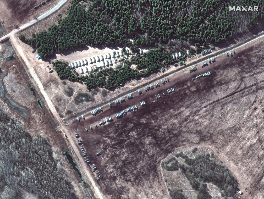
Additionally, deployments of Russian ground forces are seen in southern Belarus.

Above two imagery captures: Russian ground forces deployment near Dublin—18 miles north of the Ukraine border and approximately 45 miles northwest of Chernihiv, Ukraine  (Location: 51.749, 30.290)

Maxar also collected new satellite imagery on March 19th of Mariupol, Ukraine, that shows the aftermath of the airstrike on the Mariupol Drama Theater.

All imagery is ©2022 Maxar Technologies.

Filed Under: Earth Observation (EO), Imagery, Imaging, Military, War

Primary Sidebar

Most Read Stories

  • SpaceX Completes Two Starlink Launches In Two Days For A Total Of 106 Constellation Companions
  • Sierra Space Selects Siemens Xcelerator Software And Services For Commercial Space Venture
  • UPDATE: Blue Origin's NS-21 Mission Launch Date Is Announced
  • Maxar's Satellite Imagery Brings To Light Additional Damage To The Ukraine By Russian Attack Forces
  • Continuing Their Support For USAF Geospatial Intelligence Is Raytheon Intelligence & Space

About Satnews

  • Contacts
  • History

Archives

  • May 2022
  • April 2022
  • March 2022
  • February 2022
  • January 2022
  • December 2021
  • November 2021
  • October 2021
  • September 2021
  • August 2021
  • July 2021
  • June 2021
  • May 2021
  • April 2021
  • March 2021
  • February 2021
  • January 2021
  • December 2020
  • November 2020
  • October 2020
  • September 2020
  • August 2020
  • July 2020
  • June 2020
  • May 2020
  • April 2020

Secondary Sidebar

x
Sign up Now (For Free)
Access daily or weekly satellite news updates covering all aspects of the commercial and military satellite industry.
Invalid email address
Notify Me Regarding ( At least one ):
We value your privacy and will not sell or share your email or other information with any other company. You may also unsubscribe at anytime.

Click Here to see our full privacy policy.
Thanks for subscribing!