
An announcement from Soar‘s Earth maps and imagery platform, in partnership with the Chinese Aerospace Science and Technology Corporation (CASC), is offering its latest feature of high-resolution imagery from the SuperView satellite constellation. And, using Soar, will now be able to task the SuperView satellites to collect newly acquired imagery over their desired location(s) of choice, anywhere on Earth, at a fixed rate of $10 per square kilometer.
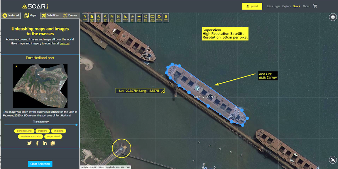
Launched in 2018 (01 and 02) and 2018 (03 and 04) from the Taiyuan Satellite Launch Center in China, the four sun-synchronous SuperView satellites operate at an altitude of 500km and can monitor daily any location on the Earth at 50cm per pixel image resolution. At this zoom level, ground features such as individual trees, fences, cars and trucks can be all seen.
Soar CEO Amir Farhand said that partnerships with global imagery organizations allow for a unique supplier to end user access via the Soar platform. The benefits are twofold. The opportunity for CASC is direct access to the huge international market for satellite imagery via a turn key, easy to use solution. For Soar, it is the privilege to showcase the tremendous leap the Chinese space program has made in providing extremely fast turn around high-resolution satellite imagery at incredibly low prices.
New tasked SuperView satellite imagery is fast-tracked and delivered directly to the customer through Soar, where users can make the most of the fully secure mapping platform allowing for further image analysis, reporting and sharing.
Farhand added that after successful image capture, all SuperView imagery is stitched, geo referenced, and delivered as a single natural color mosaic. Meaning, there is no more mucking around with raw files. No extra costs. We do this with the aim to provide the best possible product for their customers. Considering the average cost for the similar quality imagery from other suppliers is typically up to 5 times, anyone can now have access to high-resolution satellite imagery with relative ease — from K-12 school teachers to multinational mining companies.
For customers who are interested in imaging the recent past, Soar has also integrated with SuperView constellation’s database of archived imagery, which started from June 1, 2018. Via Soar customers can search the SuperView archive, preview, and purchase at a fixed rate of $6 per square kilometer.
The announcement makes SuperView the next major satellite content provider after NASA’s Landsat (30m per pixel) and the European Space Agency’s Sentinel (10m per pixel), which Soar continues to provide global access to, free of charge.